Lake of the Woods951,000 acres
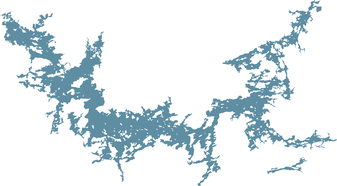 Lac Seul409,000 acres
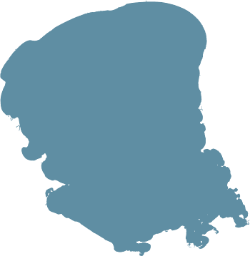 Mille Lacs132,500 acres
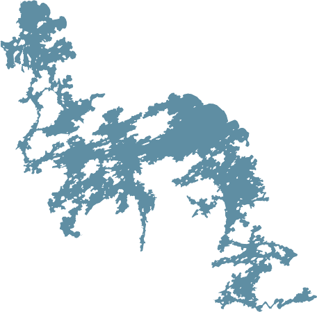 Eagle Lake68,000 acres
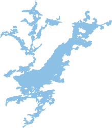 Sydney & Kilburn17,570 acres
Walleye lake comparison · 16 lakes
The same measures for every lake: what you can keep, how crowded the water is, how often wind shuts the main lake, what sits upstream and how far you drive. Sydney & Kilburn are highlighted throughout.
We’ve made every effort to be accurate, but some figures are estimates and there may be errors or gaps. How we measured
Key numbers for every lake. Gold marks the best value in each column. Tap a lake name for its own page and map.
| Lake | Walleye kept a day | Avg boatsa day | Rough days | Clearest water | Deepest | Miles of structure / 1,000 acres | Hours from Minneapolis |
|---|---|---|---|---|---|---|---|
| Sydney & Kilburn | 2 | 10* | 1.7 | 26 ft | 240 ft | 12.5 | 7 + 0.5 fly |
| Sydney Lake | 2 | – | 1.7 | 26 ft | 240 ft | 10.4 | 7 + 0.5 fly |
| Kilburn Lake | 2 | – | 0 | 11 ft | 213 ft | 21.4 | 7 + 0.5 fly |
| Eagle Lake | 2 | ? | 1.8 | 17 ft | 110 ft | 7.1 | 7.5 |
| Lac Seul | 4 | 339 | 8.4 | ? | 155 ft | 5.6 | 8.5 |
| Lake of the Woods | 2 | 727 | 0.6 / 84.7 | 17 ft | 210 ft | 3.7 | 7 |
| Rainy Lake | 1 | 297 | 7.5 | 9 ft | 161 ft | 8.9 | 6 |
| Winnipeg River | 2 | 179 | 0 | ? | ? | 14.7 | 7.75 |
| Red Lake | 4 | ? | 2.5 | 8½ ft | 140 ft | 7.8 | 9 |
| Trout Lake | ? | ? | 19.5 | 19 ft | 155 ft | 5.5 | 9 + 0.3 fly |
| Lake St. Joseph | 4 | ? | 2.8 | ? | ? | 8.4 | 11 |
| Mille Lacs | 3 | 462 | 31.1 | 12 ft | 42 ft | 0.7 | 1.75 |
| Lake Erie (Western Basin) | 6 | 1,013 | 88.7 | 8½ ft | 62 ft | 0.8 | 11.3 |
| Island Lake | ? | ? | 1.7 | ? | 195 ft | 13.0 | 8 + 1.5 fly |
| Lac La Ronge | 2 | ? | 46.2 | ? | 135 ft | 5.2 | 17 |
| Réservoir Gouin | 8 | 266 | 0.6 | ? | ? | 10.0 | 24 |
| West Hawk Lake | 4 | ? | 0.3 | ? | 377 ft | 6.5 | 8 |
| Lac du Bonnet | 4 | ? | 6 | ? | ? | 5.8 | 9.5 |
? means we couldn’t find accurate data or a close estimate for that lake. Sydney and Kilburn are shown together and on their own; both are fished from the one camp, so boats are counted for the two lakes together (–). Lake of the Woods rough days: Kenora Bay / Big Traverse (Baudette). Avg boats a day counts summer anglers, two to a boat; Lake of the Woods, Rainy and Erie count the waters with published surveys. *Sydney and Kilburn’s 10 is a season average: some weeks there are as many as 20 boats, some weeks almost none. Miles of structure counts shoreline plus island shores for every 1,000 acres of water. How we measured
Smallest to largest, all at one scale, with Sydney and Kilburn in darker blue. Tap or hover a lake for its details. Big lakes mean more water, but also more boats, more wind and more miles to run. Sydney’s islands and arms pack a lot of fishable shoreline into a lake you can cover in a day.

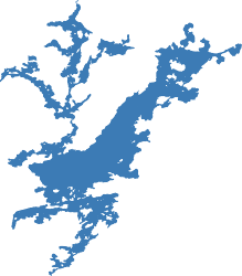
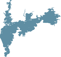
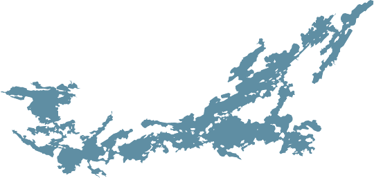
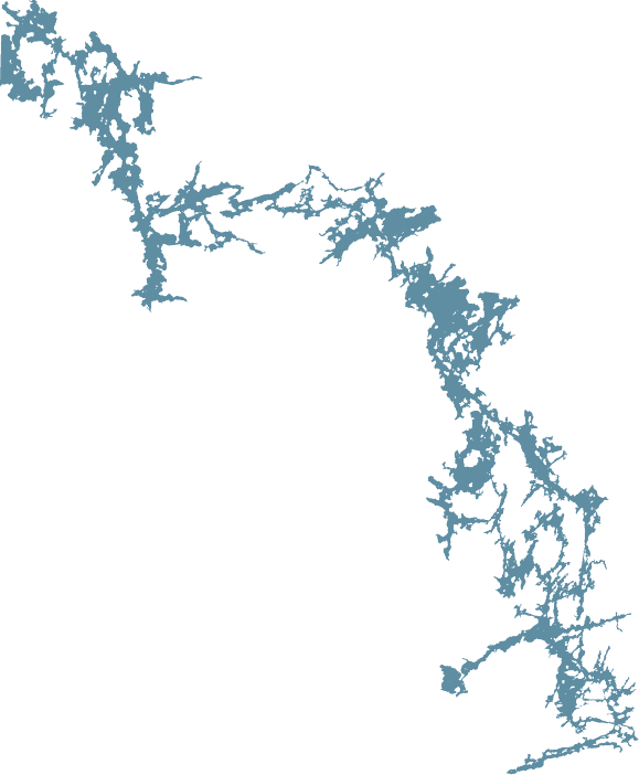
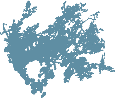
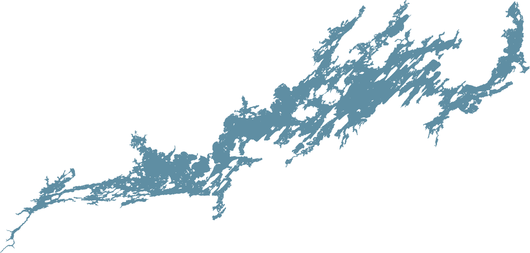
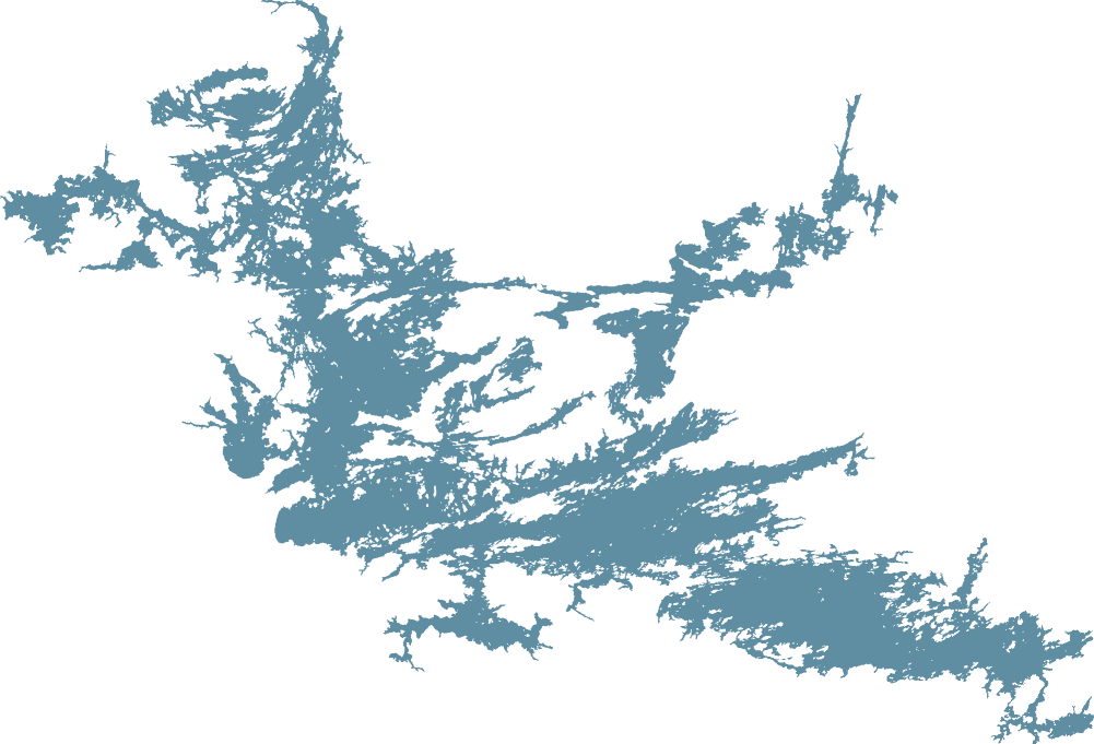

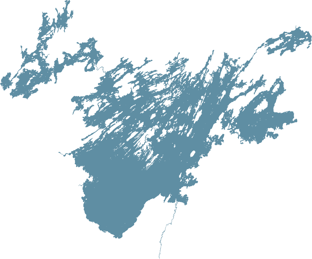
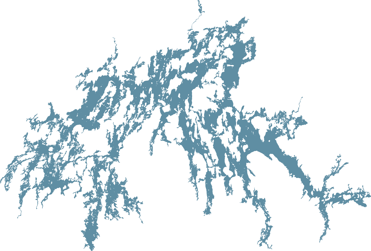

Outlines from Ontario, Minnesota, Saskatchewan and Manitoba government data, NOAA and OpenStreetMap. Lake Erie is shown whole, at half scale, below the others. Tap any lake for its detailed map.
Each lake has its own page with a map and a line-by-line comparison against Sydney & Kilburn. Pick one:
The big question beyond walleye: what else can you fish for on the same trip? Here are the five species most anglers come north for, and which lakes have them as a main target.
| Lake | Walleye | Northern pike | Lake trout | Muskie | Smallmouth bass |
|---|---|---|---|---|---|
| Sydney Lake | ● | ● | ● | ● | |
| Kilburn Lake | ● | ● | ● | ● | |
| Eagle Lake | ● | ● | ● | ● | ● |
| Lac Seul | ● | ● | ● | ● | |
| Lake St. Joseph | ● | ● | ● | ||
| Trout Lake (Red Lake) | ● | ● | ● | ||
| West Hawk Lake | ● | ● | ● | ● | |
| Lac La Ronge | ● | ● | ● | ||
| Lake of the Woods | ● | ● | ● | ● | ● |
| Rainy Lake | ● | ● | ● | ||
| Winnipeg River | ● | ● | ● | ● | |
| Red Lake | ● | ● | |||
| Mille Lacs | ● | ● | ● | ● | |
| Lac du Bonnet | ● | ● | ● | ||
| Réservoir Gouin | ● | ● | |||
| Lake Erie | ● | ● |
Sydney and Kilburn give you walleye, trophy northern pike, lake trout and smallmouth bass on the same water, so you can switch species in the same day.
Sources and method: species
Cisco (tullibee) and whitefish are rich, oily baitfish. Walleye and pike that feed on them put on weight fast. Invasive rainbow smelt compete with young walleye and cisco. Mayfly hatches off soft mud flats are a midsummer feast.
| Lake | Cisco | Whitefish | Smelt-free | Mayfly mud flats |
|---|---|---|---|---|
| Sydney + Kilburn | ● | ● | ● | ● |
| Trout Lake (Red Lake) | ● | ● | ● | ? |
| Eagle Lake | ● | ● | ● | ? |
| Lac Seul | ● | ● | – | ● |
| Red Lake | ● | ● | – | ● |
| Lake of the Woods | ● | ● | – | ● |
| Rainy Lake | ● | ● | – | ● |
| Winnipeg River | ? | ● | – | ? |
| Lac La Ronge | ● | ● | ● | ? |
| Réservoir Gouin | ● | ● | ● | ? |
| Lake St. Joseph | ? | ? | ? | ● |
| Mille Lacs | declining | ? | ? | ● |
| Lake Erie (W. Basin) | – | ● | – | ● |
Sydney has all four: cisco, whitefish, no smelt on record and mayfly mud flats along its rocky shores. A federal study in the late 1980s found Sydney's cisco larger and fatter than in most lakes it sampled.
Sources and method: what the walleye eat
Daily walleye limit for non-residents, with the size rules that go with it. Tighter limits leave more big fish in the lake.
Our camp rule: keep 2 walleye 18 inches or under and release every bigger fish. Sydney also sits in Ontario's Sydney Lake Area, one of the few parts of the province with its own lower limits for visiting anglers.
Sources and method: keep limits
How far down you can see in summer, at each lake's clearest spot, and which kinds of water it has. Walleye hold deeper in clear water and shallower in stained water, so a lake with both gives you a bite in bright sun and on dark days.
| Lake | Clearest summer reading | Clear water | Tea-stained bays | Green, muddy or murky |
|---|---|---|---|---|
| Sydney Lake | 26 ft | ● | ● | – |
| Kilburn Lake | 11 ft | – | ● | – |
| Trout Lake (Red Lake) | 19 ft | ● | ● | – |
| Eagle Lake | 17 ft | ● | ● | – |
| Lake of the Woods (Ontario) | 17 ft | ● | ● | ● |
| Mille Lacs | 12 ft | ? | – | ● |
| Rainy Lake | 9 ft | – | ● | – |
| Red Lake | 8½ ft | – | ● | ● |
| Lake Erie (W. Basin) | 8½ ft | – | – | ● |
| Lake of the Woods (Big Traverse) | under 6½ ft | – | – | ● |
Sydney's main basin is one of the clearest walleye waters in the region, about 26 feet. Its stained bays and much of Kilburn hold walleye shallow on bright days.
Sources and method: water clarity
Deepest spot in each lake. Deep, cold, well-oxygenated water is what lets cisco and whitefish, the walleye's richest food, live through summer.
Sydney drops to about 240 feet and averages 65 feet deep, so cisco and whitefish always have cold water. Shallow lakes like Mille Lacs and Lake Erie's Western Basin warm right through in summer; Mille Lacs had cisco die-offs in the 2026 summer heat.
Sources and method: depth
Miles of shoreline and island shore for every 1,000 acres of water. Walleye, pike and bass hold on points, reefs, bays and island edges, so more shoreline per acre means more spots to fish and a shorter boat ride to the next one.
Kilburn’s long arms and Sydney’s islands, bays and river mouth pack more fishable edge into every acre than the big drive-to lakes. Mille Lacs and Lake Erie’s Western Basin are wide open water, with less than 1 mile of shoreline per 1,000 acres.
Sources and method: structure
On Sydney and Kilburn you’re never more than about half an hour from camp. If your motor quits, or you don’t come back when you said you would, we come and find you. To compare, we measured the longest run by water at the same 23 mph from a typical camp on each lake: the middle of all the spots on its shore, so half of them are closer to the far end and half are farther.
From our camp the farthest water is Leano Falls at the top of Kilburn’s centre arm, about 10 miles and 31 minutes through Park Narrows and 2nd Narrows. West Hawk is closer and Lac du Bonnet about the same, but they are small drive-to lakes with cottages on the shore. On the big lakes a typical camp is two to three and a half hours from the far end, and on Lake Erie more than nine. Sydney and Kilburn give you big-fish water, 240 ft deep, with lots of structure and little fishing pressure, all within half an hour. *Boats a day is a season average: some weeks there are as many as 20, some weeks almost none.
| Lake | Typical camp to farthest water | Best spot for a camp | Deepest | Miles of structure / 1,000 acres | Avg boats a day |
|---|---|---|---|---|---|
| Sydney & Kilburn, our camp | 31 min · 10 mi | – | 240 ft | 12.5 | 10* |
| West Hawk Lake | 9 min · 3 mi | 6 min · 2 mi | 377 ft | 6.5 | ? |
| Lac du Bonnet | 30 min · 12 mi | 21 min · 8 mi | ? | 5.8 | ? |
| Trout Lake (Red Lake) | 46 min · 18 mi | 32 min · 12 mi | 155 ft | 5.5 | ? |
| Mille Lacs | 46 min · 18 mi | 36 min · 14 mi | 42 ft | 0.7 | 462 |
| Red Lake | 1 h 04 min · 25 mi | 44 min · 17 mi | 140 ft | 7.8 | ? |
| Eagle Lake | 1 h 17 min · 30 mi | 55 min · 21 mi | 110 ft | 7.1 | ? |
| Lac La Ronge | 1 h 32 min · 35 mi | 1 h 06 min · 25 mi | 135 ft | 5.2 | ? |
| Island Lake (MB) | 1 h 53 min · 43 mi | 1 h 18 min · 30 mi | 195 ft | 13.0 | ? |
| Winnipeg River | 1 h 57 min · 45 mi | 1 h 16 min · 29 mi | ? | 14.7 | 179 |
| Rainy Lake | 1 h 59 min · 46 mi | 1 h 20 min · 31 mi | 161 ft | 8.9 | 297 |
| Lake Erie (W. Basin) | 2 h 20 min · 54 mi | 1 h 40 min · 38 mi | 62 ft | 0.8 | 1,013 |
| Réservoir Gouin | 2 h 38 min · 61 mi | 1 h 49 min · 42 mi | ? | 10.0 | 266 |
| Lac Seul | 3 h 05 min · 71 mi | 2 h 02 min · 47 mi | 155 ft | 5.6 | 339 |
| Lake of the Woods | 3 h 20 min · 77 mi | 2 h 05 min · 48 mi | 210 ft | 3.7 | 727 |
| Lake Erie (whole lake) | 9 h 18 min · 214 mi | 5 h 48 min · 133 mi | 210 ft | 0.8 (W. Basin) | 1,013 (W. Basin) |
Best spot for a camp: the one place on the shore closest to all of the lake’s water. Sources and method: distance from camp
An average summer day, with two anglers to a boat. Left: boats fishing the whole lake. Right: water each boat has to itself.
On an average day about 10 boats* share Sydney and Kilburn, roughly 1,760 acres each. Spread evenly, your nearest neighbour would be more than a mile away, even in a 20-boat week. On Mille Lacs and the Winnipeg River it is one boat every 290 acres, about two-thirds of a mile apart, and Lake Erie's Ohio waters average about 1,000 boats a day. *Average for the season: some weeks there are as many as 20 boats on Sydney and Kilburn (about 880 acres each), and some weeks almost none.
Sources and method: boats on the water
Lodges, resorts or charters working each lake, plus cottages and public boat launches, where a count exists. Every cottage is another boat on the water.
Sources and method: lodges and cottages
Islands break up the wind. Left: days each season (May 15–Sep 30) when waves top 2.5 ft across the most exposed part of the lake, enough to keep a 16–18 ft boat off the main lake. Right: share of the lake within a quarter mile of shore or an island.
On a windy day at Sydney you move to the lee side of an island and keep fishing. On open lakes like Mille Lacs and Erie there is nowhere to tuck in.
Sources and method: wind and waves
Documented sources of disturbance on or above each lake. A dot means it is there; a dash means none was found.
| Lake | Dam or reservoir | Industry, past or present (mine, mill, plant) | Town sewage on or upstream | Algae blooms | Town on the lake | Highway to the lake | Count |
|---|---|---|---|---|---|---|---|
| Sydney Lake | – | – | – | – | – | – | 0 |
| Kilburn Lake | – | – | – | – | – | – | 0 |
| Trout Lake (Red Lake) | – | – | – | – | – | – | 0 |
| Eagle Lake | – | – | – | – | ● | ● | 2 |
| West Hawk Lake | – | – | – | – | ● | ● | 2 |
| Mille Lacs | – | – | – | – | ● | ● | 2 |
| Réservoir Gouin | ● | – | – | – | ● | – | 2 |
| Lake St. Joseph | ● | – | – | – | ● | ● | 3 |
| Rainy Lake | ● | ● | – | – | ● | ● | 4 |
| Lac La Ronge | ● | – | ● | – | ● | ● | 4 |
| Lac Seul | ● | ● | ● | – | ● | ● | 5 |
| Red Lake | ● | ● | ● | – | ● | ● | 5 |
| Lac du Bonnet | ● | ● | ● | – | ● | ● | 5 |
| Winnipeg River | ● | ● | ● | – | ● | ● | 5 |
| Lake Erie | – | ● | ● | ● | ● | ● | 5 |
| Lake of the Woods | ● | ● | ● | ● | ● | ● | 6 |
Sydney and Kilburn have no road, town, dam, mine or mill. Réservoir Gouin is reached on gravel forestry roads rather than a highway. Many big walleye lakes are hydro reservoirs whose levels rise and fall, or sit below town sewage plants, mills and old mines.
Sources and method: clean water
Not from Minneapolis? Check drive times from your city or town →
Sydney is a normal one-day drive to Kenora, then a short float-plane hop. You trade a 30-minute flight for a lake with no road to it.
Sources and method: getting there
Where every number comes from. Figures were researched in October and November 2026.
We have made every effort to make these comparisons accurate and fair, using government surveys and published sources wherever we could. Some figures are estimates or model results, sources can be out of date, and there may be errors or gaps. A ? means we couldn’t find accurate data or a close estimate. Check current regulations before your trip, and if you spot something we got wrong, let us know and we’ll fix it.