Fly-in fishing lake · Woodland Caribou Park, Ontario
Sydney Lake’s tea-stained neighbour: three long arms full of islands, narrows, creeks and shallow walleye bays, plus one deep trout bay. A short run up the river from our dock, with no portage.
3,330
acres of water
Smaller and more sheltered than Sydney. With Sydney and the Sturgeon River the lakes cover 17,570 acres.
213
feet deep in Trout Bay
Most of Kilburn is shallow. Trout Bay is the one deep hole, ringed by high cliffs.
3
long arms
The West, Centre and Trout Bay Arms each run 4 to 5 miles, full of islands and narrows.
Dark
tea-stained water
It warms early in spring and holds shallow walleye well into summer.

What the lake is like
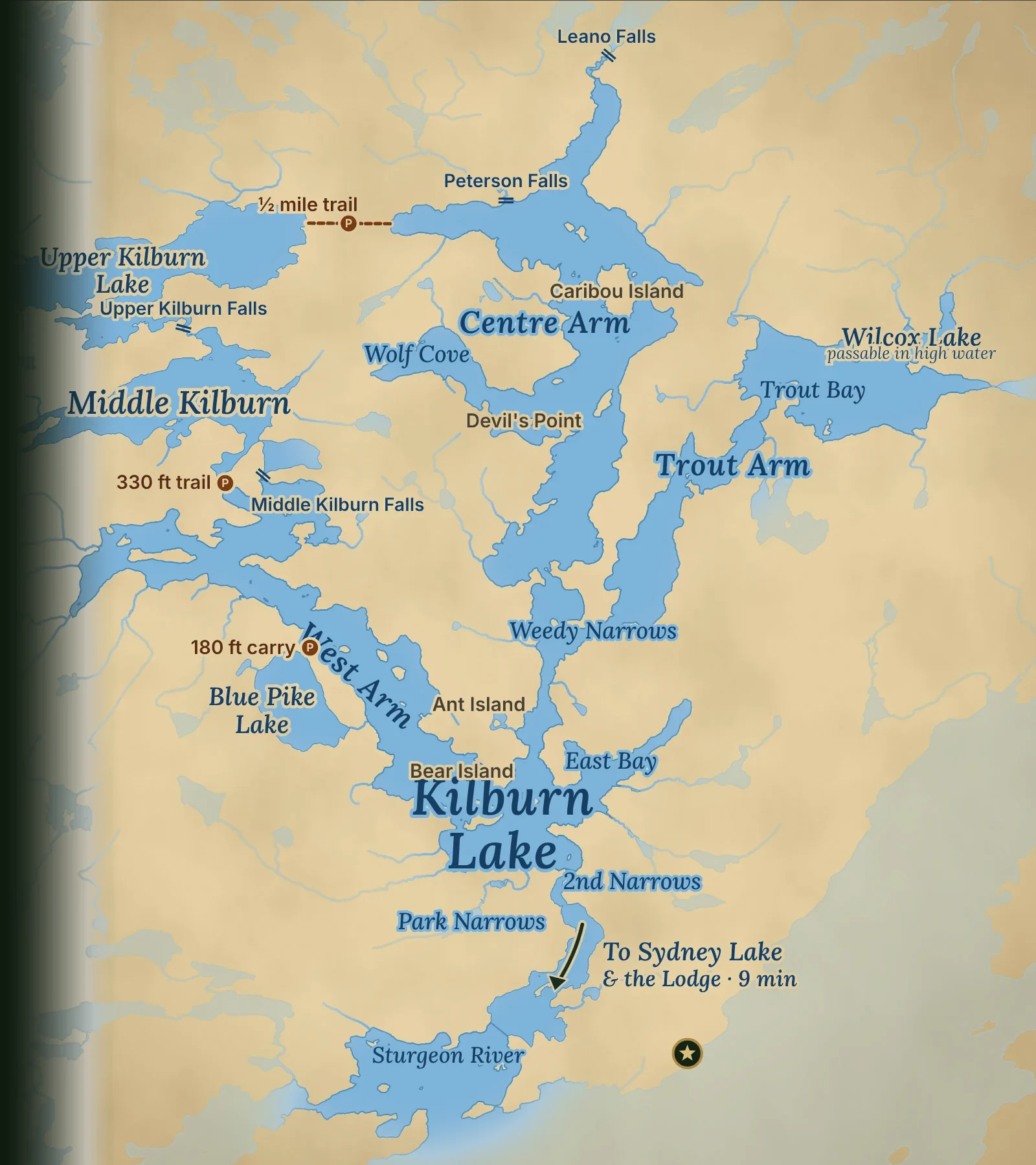
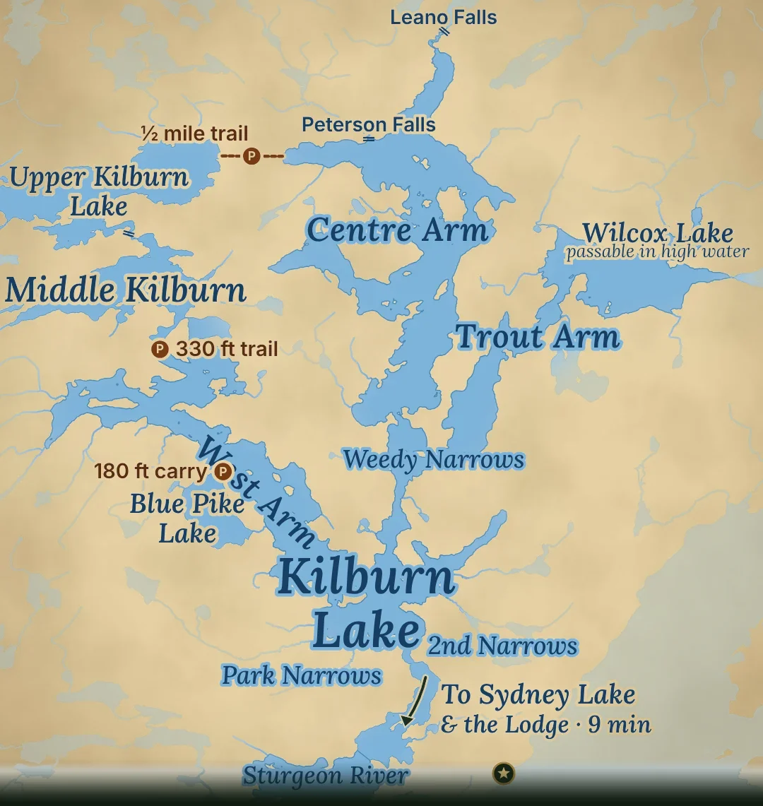
Kilburn Lake sits on the Sturgeon River system, directly north of the midpoint of Sydney Lake, inside Woodland Caribou Provincial Park. It covers about 3,330 acres, with 29 islands and about 62 miles of shoreline. Three long arms, the West, Centre and Trout Bay Arms, branch north from a small main basin, and each runs 4 to 5 miles through islands, narrows and weedy bays.
Most of the lake is shallow, dark, tea-stained water. It averages about 25 feet deep, and the main basin and East Bay are mostly 20 to 40 feet. The exception is Trout Bay, at the top of the eastern arm, where high cliffs surround the deepest water on the lake, about 213 feet down.
That makes Kilburn walleye water first. The narrows, island points, reefs and creek mouths hold walleye all season, northern pike patrol the weed bays, and Trout Bay gives Kilburn its own lake trout. Dark water warms early, so the spring bite starts sooner and the walleye stay shallow longer than on Sydney. The long, narrow arms are sheltered too: when Sydney’s main lake is rough, Kilburn is usually calm.
Getting there: from our dock it is about 3.7 miles up the Sturgeon River to Park Narrows, roughly 9 minutes at cruising speed. Park Narrows and 2nd Narrows sit about a quarter mile apart and have a slight current, so go slow or give a few pushes with a paddle, and allow about 5 minutes for the pair. No portage is needed: you are on the main basin about 14 minutes after leaving camp.
3.7 mi
Camp to Park Narrows
~9 min
At cruising speed
2 narrows
Slow, slight current
No portage
Boat straight in
The three arms
Each arm is 4 to 5 miles long, with islands, creeks, narrows and bays all along it. Here is how to find your way around.
Just over 4 miles · angles northwest
850
Acres
60–80 ft
Deepest
10
Islands
~17 mi
Shoreline
18 min
4.8 mi from camp
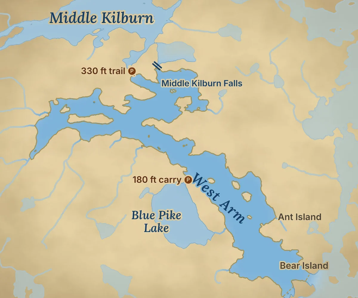
Past the second narrows is one of the best places on the lakes to watch a summer sunset. There are good shore lunch spots on the islands and the shore all the way up, and the best are near the far west end, with views of the rock cliffs. At the north end, a creek brings water in from Middle and Upper Kilburn.
West Arm reef
Shallow water on one side, deep on the other. In July and August the walleye sit right on the break.
West Arm cliffs
Rock cuts and narrows under high cliffs near the far west end, with some of the most scenic shore lunch spots on the lakes. Stay for the sunset past the second narrows.
Blue Pike Lake
A 180-foot carry off the west shore leads to Blue Pike Lake: about 160 acres and 92 feet deep, with northern pike, including the rare blue pike. No boat is kept there, but you can take one of our canoes; talk to us at the dock first.
Middle Falls & Middle Kilburn
At the north end, the creek from Middle and Upper Kilburn comes in. A 330-foot trail leads to Middle Kilburn Lake, with a boat waiting. More below.
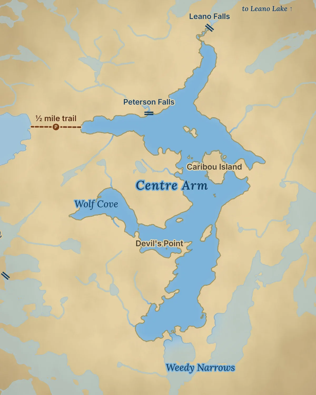
The longest arm · runs north–south
1,280
Acres, with Wolf Cove
80–100 ft
Deepest
12
Islands
~22 mi
Shoreline
21 min
6.2 mi from camp
The longest and largest arm. Its entrance is a narrows that is easy to miss, just north of the Trout Bay entrance. The narrows and islands in the north end hold walleye all season, and the south end has the big weedy pike bay. The north end is fed by the creek from Leano Lake.
Centre Arm islands
The narrows and islands at the north end hold walleye all season. Halfway up the arm are at least half a dozen good shore lunch spots.
Centre Arm weed bay
The large weedy bay at the south end of the arm, and the rocky points along its west side, are the pike spots here.
Wolf Cove
A 110-acre bay off the west side, 60 to 80 feet at its deepest.
Leano Falls
A creek from Leano Lake cascades through a boulder field at the top of the arm. In high water, find the boat-sized gap in the reeds, follow the two turns to the base of the falls and cast into the hole. It is rocky, so go carefully, then walk the portage trail on the right side of the falls.
Upper Kilburn Lake
A half-mile trail from the west shore of the upper arm leads to Upper Kilburn Lake: about 675 acres and 160 feet deep. No boat is kept there; ask at the dock if you'd like to take a canoe in.
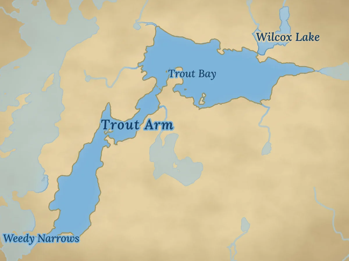
The eastern arm
690
Acres, with Trout Bay
213 ft
Deepest, in Trout Bay
3
Islands
~12 mi
Shoreline
21 min
6.0 mi from camp
A mile north of the narrows, look on your right for a path through the weeds, with a beaver house on its north side. Stay in the centre of the channel. It runs a mile and a half north beside the Centre Arm, then turns hard right through a boulder field, so go slow. Another mile north and you are in Trout Bay.
Because it ends in Trout Bay, this is the deepest of the three arms, averaging about 55 feet.
Trout Bay
Kilburn’s deepest water, about 213 feet, under high cliffs. The place on Kilburn for lake trout. More below.
Wilcox Lake
A small, seldom-fished lake off the north side of Trout Bay that you can reach by boat in high water. More below.


Off the arms
Three places worth the extra run: Kilburn’s one deep bay, a seldom-fished lake you can boat into in high water, and the portage lake off the West Arm.
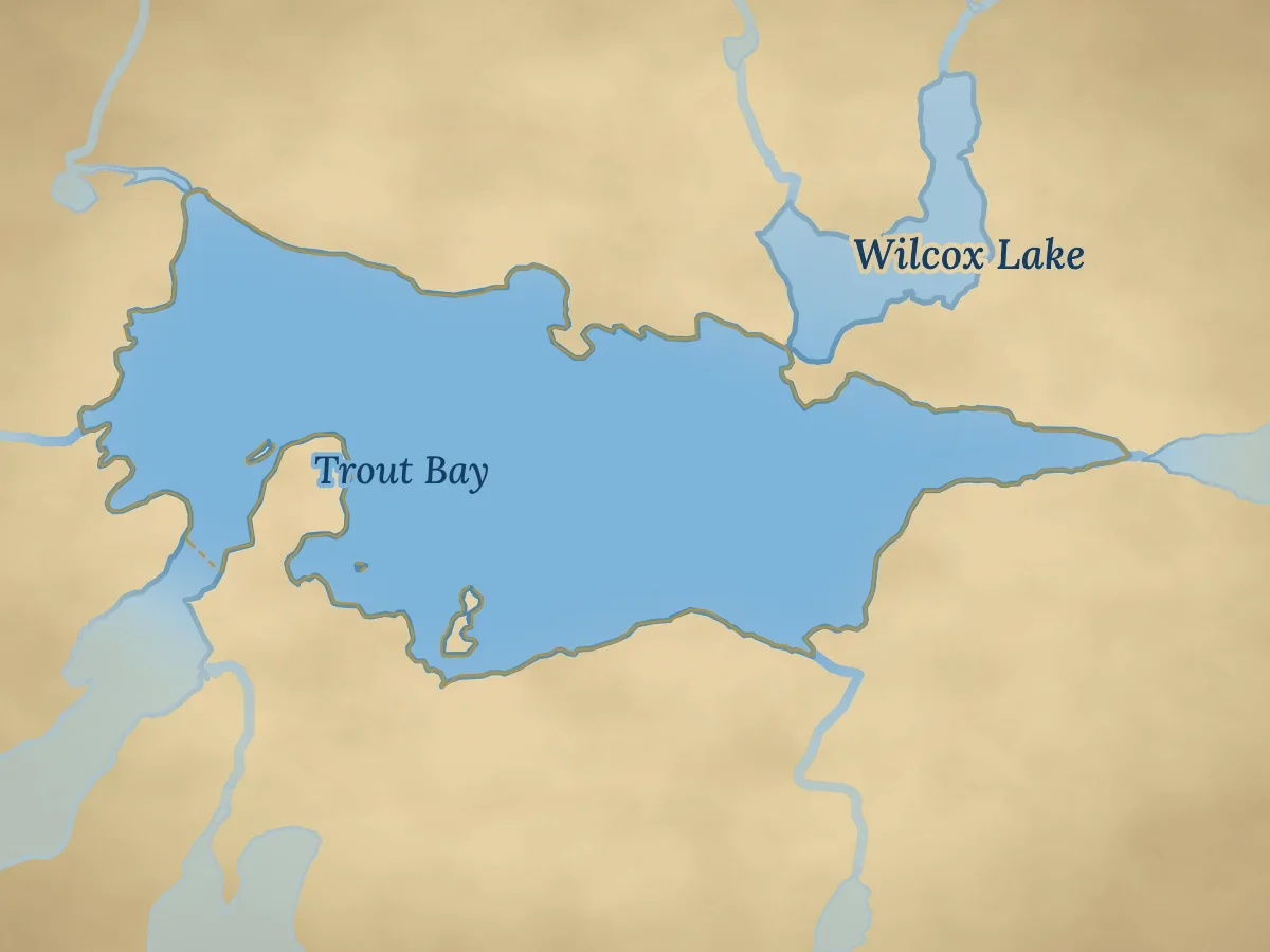
Top of the eastern arm
410
Acres
213 ft
Deepest on Kilburn
~80 ft
Average depth
2
Islands
26 min
8.1 mi from camp
High cliffs surround Kilburn’s deepest water, about 213 feet down. The bay averages about 80 feet, so it stays cold all summer, and it is the place on Kilburn to catch lake trout.
Many of Trout Bay’s lake trout have dark, almost black skin and white flesh, a different look from the trout in Sydney’s main basin. Fish the cliffs and drop-offs in spring and fall, and jig the deep water in summer.
Best for: lake trout under the cliffs
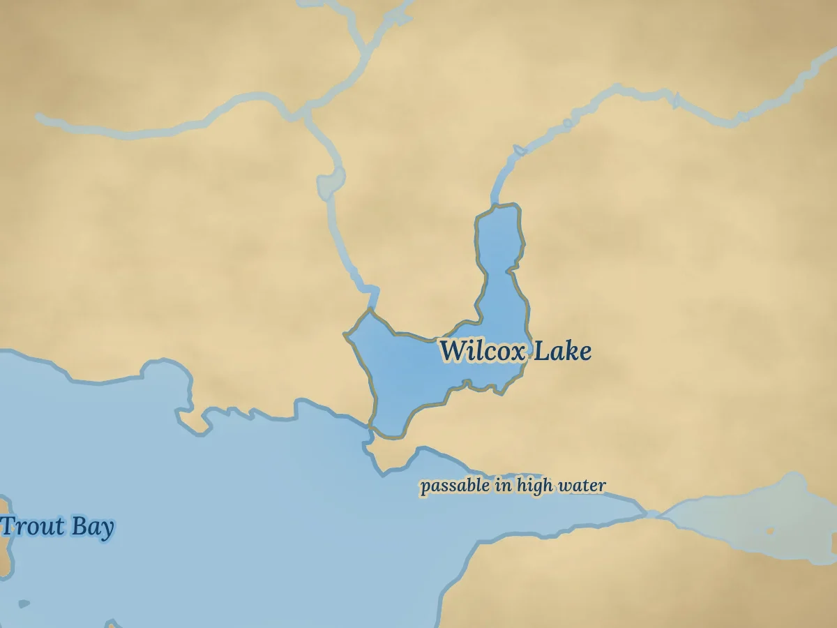
Behind Trout Bay
45
Acres
10–20 ft
Deepest
~1.7 mi
Shoreline
29 min
9.2 mi from camp
A small lake on the north side of Trout Bay, joined to it by a shallow channel. In very high water years you can take the boat right in. It is seldom fished, with lots of walleye and some pike.
Ask first: we’ll tell you at the dock whether the water is high enough this year
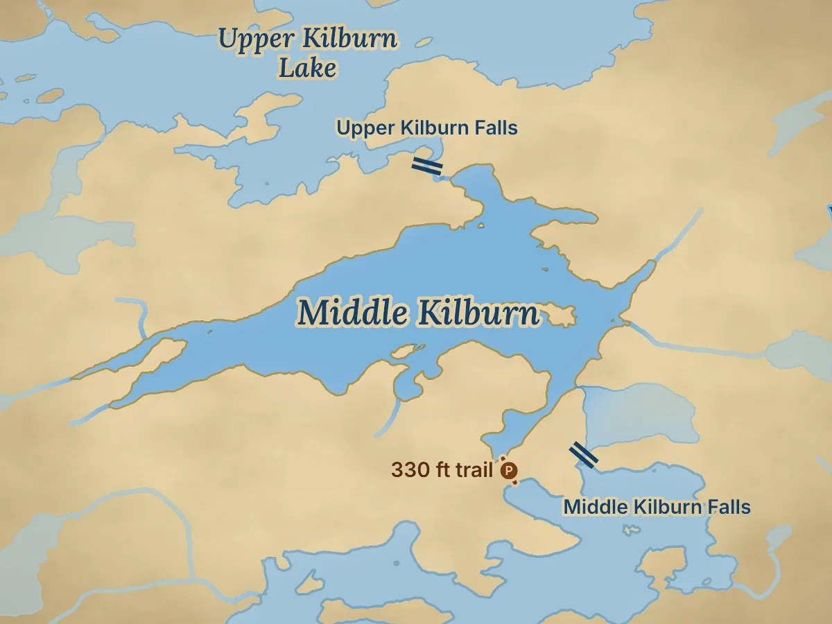
Portage lake · off the West Arm
378
Acres
~200 ft
Deepest
10
Islands
330 ft
Trail, boat waiting
26 min
8.0 mi to the trail
At the north end of the West Arm, the creek from Middle and Upper Kilburn comes in at Middle Falls. Beside it, a 330-foot trail leads over to Middle Kilburn Lake, where we keep a boat waiting.
Middle Kilburn covers about 378 acres, with 10 islands and about 9 miles of shoreline, and it is about 200 feet at its deepest. It holds walleye, northern pike and lake trout.
Keep going and a two-thirds-mile trail (about 3,400 feet) from Middle Kilburn reaches Dragon Lake. Upper Kilburn Lake is reached separately, by a half-mile trail from the top of the Centre Arm. Neither lake has a boat, so talk to us at the dock if you want to take a canoe.
Bring: a light pack. The walk is short and the boat is there.

Kilburn Lake on a calm morning

Wildlife
Kilburn sits inside Woodland Caribou Provincial Park, and its quiet arms and weedy bays are one of the best places on our water to see wildlife. Look for moose at the narrows and the Centre Arm entrance on summer evenings, and black bears at Leano Falls and Middle Falls in May.
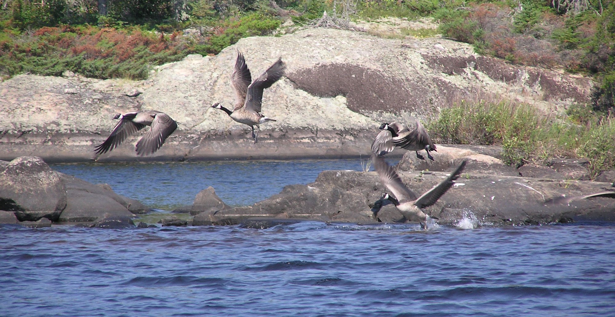
Canada geese, ducks, bald eagles and pelicans are around all season. The park is named for the woodland caribou that still live here, and they are sometimes seen swimming between islands on Sydney Lake.
Ease off the throttle as you come into a narrows or a weedy bay. That is where you are most likely to find a moose feeding.
Woodland Caribou Park →

Fishing Kilburn Lake
Kilburn is the darker, shallower half of our water. It fishes differently from Sydney, and it is often where the walleye are. Every group gets a waterproof lake map, and when you arrive we mark the spots on this page and what is working that week.
The main event
Shallow bays, narrows and breaks
Kilburn’s tea-stained bays are some of our best walleye water. Dark water warms first, so the bite starts early, and the fish often stay shallow longer than on Sydney. Work the narrows, the island points in the Centre Arm and the West Arm reef. In fall, back-troll the deeper flats.
Trophy pike
Weed bays, creek mouths, rocky points
Shallow weedy bays, creek mouths and rocky points make Kilburn classic pike water. Try the big weed bay at the south end of the Centre Arm, the falls and creek mouths, and the deep side of any point when the sun is high. Use a leader: the biggest pike cut weak line.
One deep bay
Over 200 feet deep
Trout Bay holds Kilburn’s lake trout. Many of them have dark, almost black skin and white flesh, a different look from the trout in Sydney’s main basin. Fish the cliffs and the drop-offs in spring and fall, and jig the deep water in summer.
More:Lake trout fishing


Two lakes, one trip
Sydney: about 14,240 acres of clear water counting the Sturgeon River, a main basin 240 feet deep and plenty of open water. Kilburn: about 3,330 acres of dark, tea-stained water, mostly shallow, with long sheltered arms and one 213-foot bay.
Fishing both in one trip is the point. When the wind blows on Sydney, head up the river to Kilburn. When the walleye slide deep in August, Sydney’s reefs come into their own. Camp sits at the midpoint of Sydney, so both are a short run away.
Both lakes are inside Woodland Caribou Provincial Park and Ontario’s Trophy Waters, with one lodge, no roads, no stocking and catch-and-release of trophy fish since 1987. Limits change, so check the current Ontario regulations before you come.
Sydney Lake →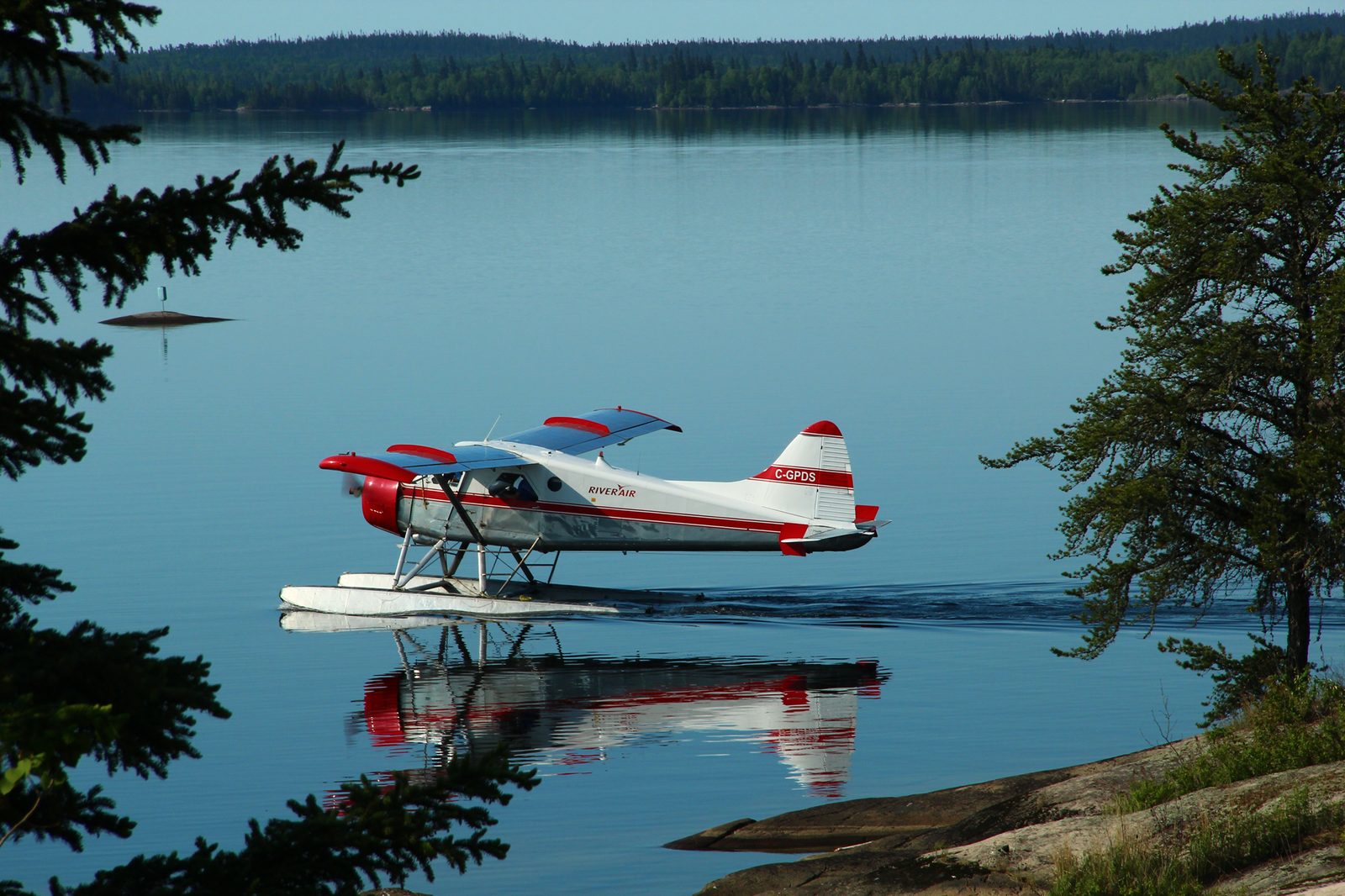
Questions
In Woodland Caribou Provincial Park, in the Kenora District of Northwestern Ontario, directly north of the midpoint of Sydney Lake. It is fly-in only: about 30 minutes by float plane north of Kenora, then a short boat ride up the Sturgeon River from our lodge.
No. From Sydney Lake you run up the Sturgeon River and through two narrows with a slight current. Slow, careful motoring gets you through.
Most of Kilburn is shallow, with dark, tea-stained water. The deepest spot is in Trout Bay, about 213 feet, surrounded by high cliffs.
Walleye and northern pike are the main fish, and Trout Bay holds lake trout. Middle Kilburn, a 330-foot portage off the West Arm, has walleye, pike and lake trout too.
About 3.7 miles up the Sturgeon River to Park Narrows, roughly 9 minutes, then about 5 minutes through the two narrows. The main basin is about 14 minutes from our dock, and the far end of Trout Bay about 26.
Yes. A 330-foot trail at the north end of the West Arm leads to Middle Kilburn, where a boat is waiting. Upper Kilburn is a half-mile trail from the top of the Centre Arm, and Blue Pike Lake is a 180-foot carry off the West Arm.
Plan your trip
Ours is the only lodge on Kilburn. Fly in from Kenora, stay in a lakeside cabin on Sydney, and run up the river whenever you like. The season runs from the third Saturday in May (May 15 in 2027) to September 30. Pick your dates and I’ll help you plan the rest.
Check dates →More fishing on Sydney Lake: Walleye · Northern pike· Lake trout · Sydney Lake