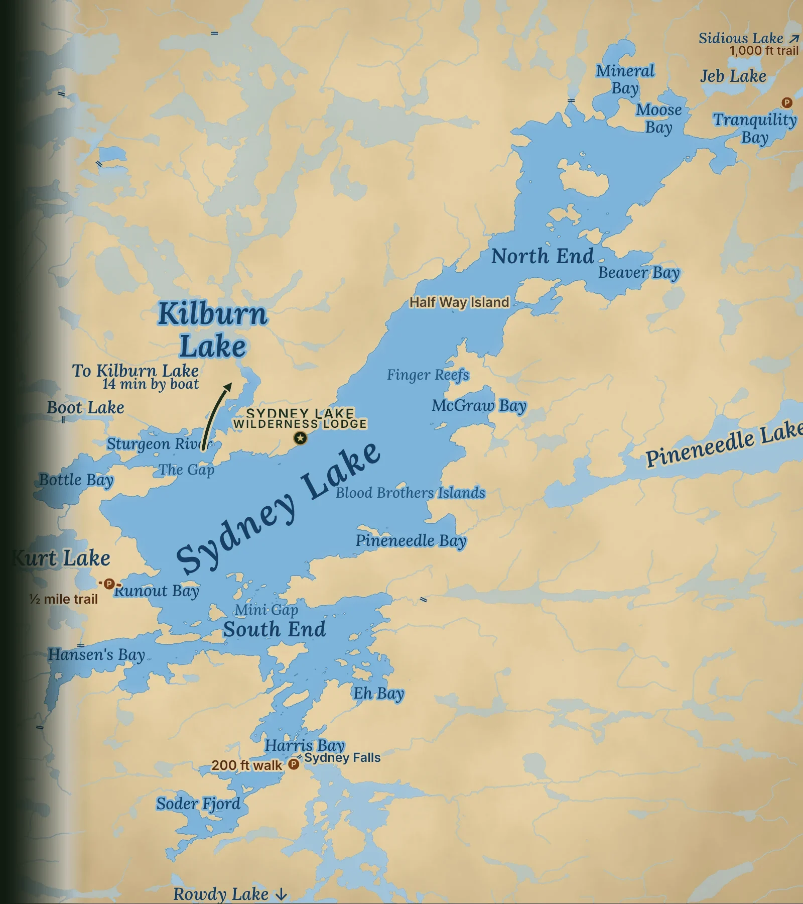
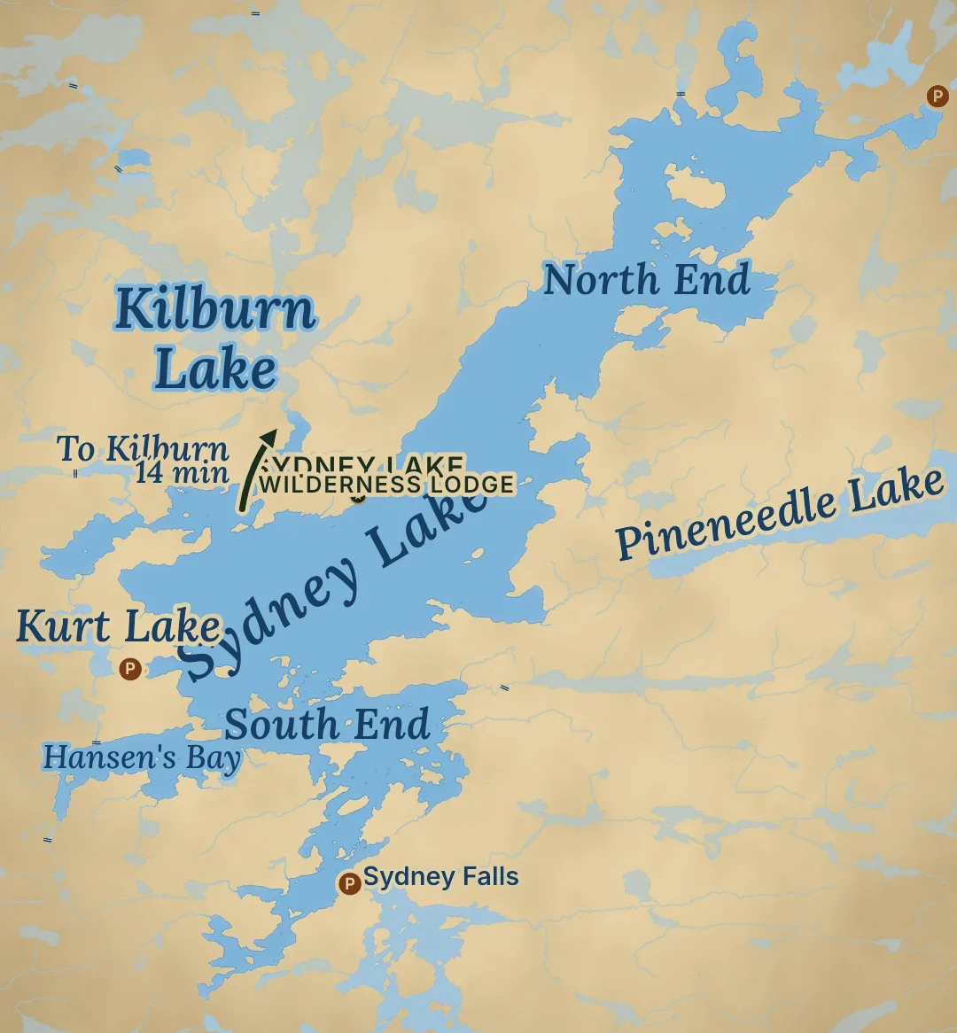
Map of Sydney Lake, Ontario, with its bays, islands, portage trails and the lodge on the west shoreMap of Sydney Lake, Ontario, with its bays, islands, portage trails and the lodge on the west shore

Fly-in fishing lake · Woodland Caribou Park, Ontario

Sydney Lake, Ontario

A big, deep, clear lake ringed by dark, shallow bays and 91 islands. Walleye, northern pike and lake trout, one lodge, and no roads. Thirty minutes by float plane north of Kenora.

14,240

acres of water

Counting the Sturgeon River. 14½ miles long and 3½ wide. Add Kilburn and you have 17,570 acres to fish.

240

feet at the deepest

Average depth about 65 feet. Cold, clear water for lake trout and cisco.

26

feet of clarity

In a lake survey, a Secchi disc stayed in sight down to 26 feet in the main lake.

91

islands

Most sit in the north and south ends. About 129 miles of shoreline.

Aerial view of forested islands on Sydney Lake, Ontario

What the lake is like

Sydney Lake facts: clear, deep water and dark, shallow bays

Sydney Lake is a large, deep lake in the Kenora District of Northwestern Ontario. It runs about 14½ miles from northeast to southwest and is up to 3½ miles wide. The main lake is clear, cold and deep, down to 240 feet. All around it are darker, shallower bays, fed by creeks and warmed by the sun weeks before the main basin.

More than 20 creeks flow in near the head of the system, plus the Sturgeon River by way of Kilburn Lake. There is one way out: Sydney Falls at the south end, a 7-foot drop into Rowdy Lake. We sit near the headwaters, so there are no towns, mines, mills or dams upstream of us.

That mix is why the fishing is so good. The bays are where walleye and pike spawn and feed. The deep basin is full of cisco (tullibee), an oily baitfish that grows big walleye and lake trout. In a federal fisheries study of six northwestern Ontario lakes, the biggest walleye came from Sydney Lake, and its walleye were among the fastest growing.

The lake is named for Sydney Forester, who surveyed it for the Dominion of Canada in 1926. It is still reached only by float plane, or by canoe and portage. The nearest road access to the park is at Leano Lake, about 12 miles to the north.

Why these lakes →

Sydney Lake data

Sydney Lake by the numbers

Physical data for Sydney Lake, Kenora District, Northwestern Ontario.

✓Location: 50°41′ N, 94°25′ W, about 60 miles north of Kenora

✓Surface area: 14,240 acres with the Sturgeon River (17,570 with Kilburn)

✓Length 14½ miles, width 3½ miles, running northeast to southwest

✓Maximum depth 240 feet; average depth 65 feet

✓Volume: about 925,000 acre-feet of water, with the Sturgeon River

✓Elevation: about 1,157 feet above sea level

✓Islands: 91, with about 129 miles of shoreline, counting the Sturgeon River (120 islands and about 190 miles with Kilburn)

✓Inflows: 20+ creeks plus the Sturgeon River; one outlet, at Sydney Falls

From the lake survey

In summer the lake is layered by temperature. The survey found water from 70°F at the surface to 45°F in the top 100 feet, with the thermocline, where it cools fastest, between 25 and 35 feet (63°F down to 53°F).

Oxygen held steady at 9.4 to 10 parts per million down to 125 feet: cold, well-oxygenated water, the kind lake trout and cisco need. The water is colourless and slightly alkaline (pH 7.6), with only 16 ppm dissolved solids.

Compare with other walleye lakes →
The camp docks and a pine-topped point on a calm morning on Sydney Lake
A calm morning at the docks
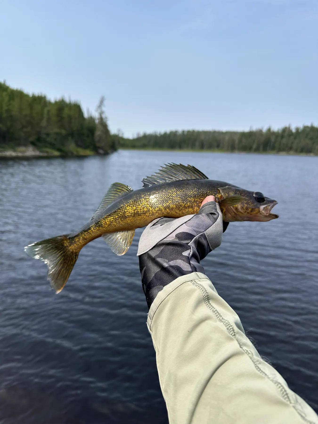
A walleye held up over the water on Sydney Lake
A Sydney Lake walleye
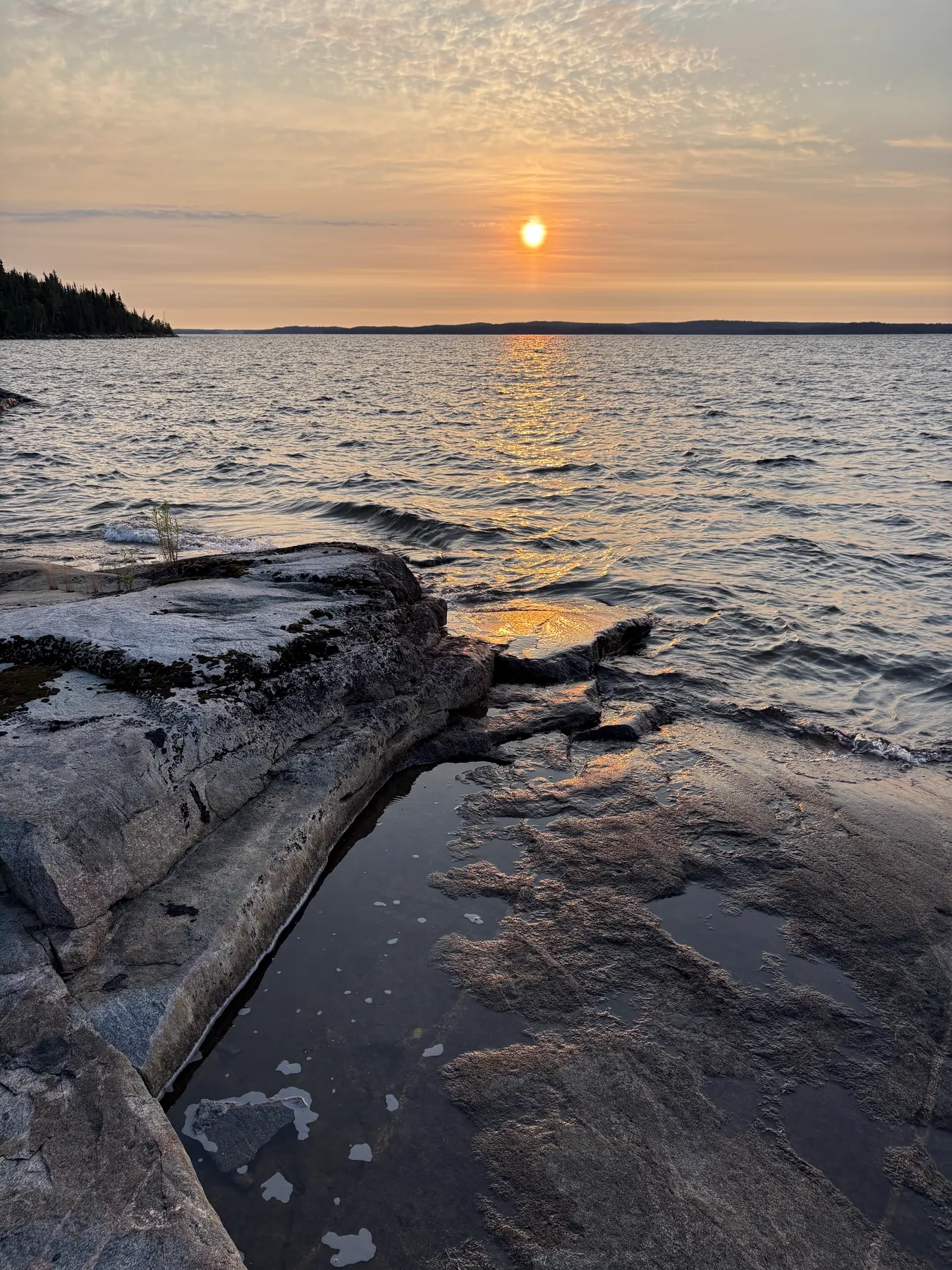
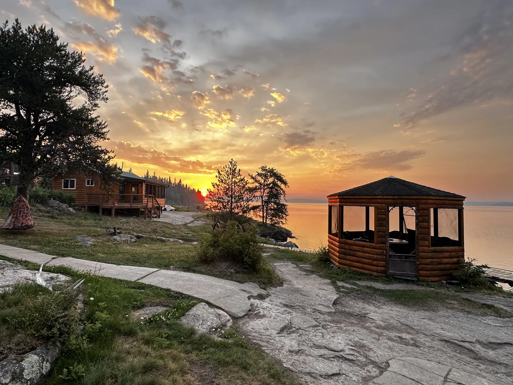
The camp gazebo on the granite shore at sunset on Sydney Lake
The gazebo at sunset

Around the lake

Sydney Lake fishing spots, bays and islands

Camp sits at the midpoint of the lake, so nothing is more than about 8 miles away. Every group gets a waterproof lake map, and when you arrive we mark these spots and what is working that week.

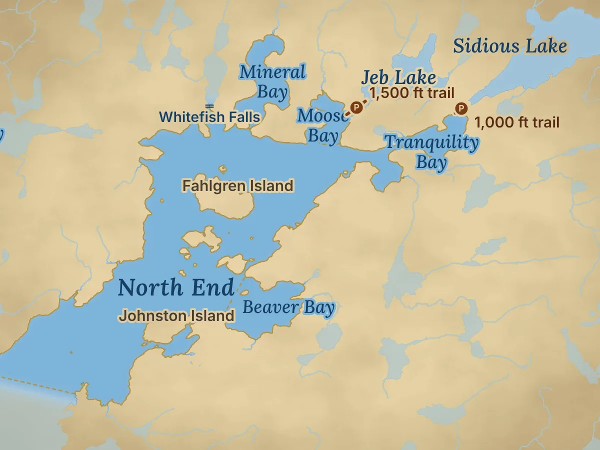
Map of the North End of Sydney Lake, Ontario, with Mineral, Moose, Tranquility and Beaver Bays and the trails to Jeb and Sidious Lakes
The North End and its bays (gold outline), with the trails to Jeb and Sidious Lakes.Explore on the interactive map →

Northeast of camp · the big basin and its bays

The North End

4,280

Acres, with its bays

150–200 ft

Deepest

21

Islands

~39 mi

Shoreline

5 min

2.1 mi from camp

The big northeast basin runs from Half Way Island up to the creek-fed bays at the head of the lake. There is deep water down the middle, 150 to 200 feet, and dark, shallow bays all around the edges.

Mineral & Tranquility Bays

Shallow, creek-fed bays at the north end, packed with walleye in June. Watch for moose along the shore, and for black bears at Sidious Creek in Tranquility Bay in May.

Beaver Bay

About 290 acres off the east side of the basin, and 80 to 100 feet at its deepest.

Sidious & Jeb Lakes

Two portage lakes just off the north bays. Sidious is about a 1,000-foot trail with a boat waiting. The Jeb Lake trail is closed for now.

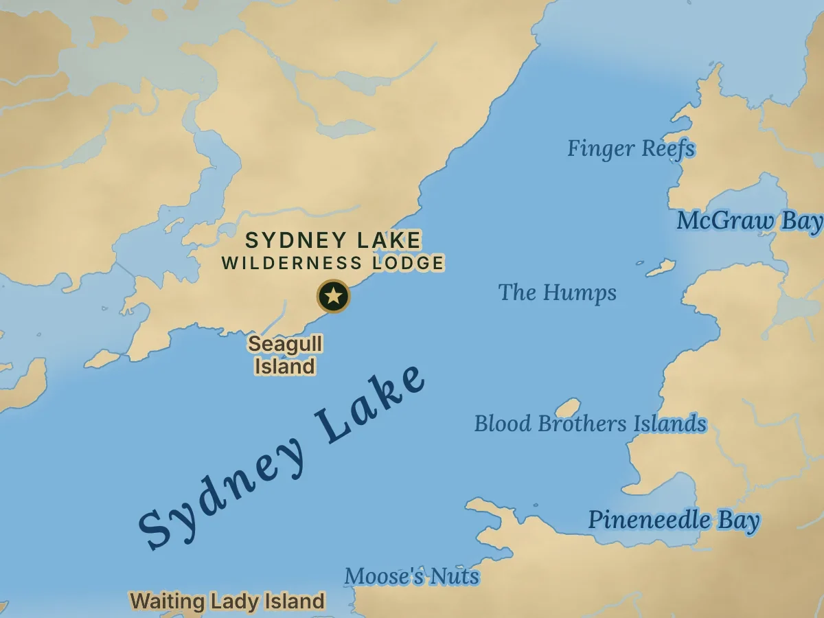
Map of the main basin of Sydney Lake, Ontario, around the lodge, with the Finger Reefs, Blood Brothers Islands and McGraw Bay
The main lake around camp (the star), with the Finger Reefs and Blood Brothers Islands.Explore on the interactive map →

In front of camp · the deep basin

The main lake

5,280

Acres

240 ft

Deepest

~110 ft

Average depth

~15 mi

Shoreline

Camp sits on the main basin, the deepest and clearest part of Sydney. Cold water down to 240 feet holds lake trout and cisco, and the reefs and island breaks that drop into it are where the big walleye go in late summer.

Finger Reefs & Blood Brothers Islands

A few minutes from camp. Reefs that fall fast into deep water: big walleye in August, and lake trout trolled at 25–45 feet in spring.

The Deep Hole

Sydney’s main basin, about 240 feet at its deepest. Summer lake trout hold over the deep water, and the islands along its south side are a fall trout spot.

McGraw Bay

About 170 acres on the east shore, 40 to 60 feet at its deepest and about 6 minutes from camp.
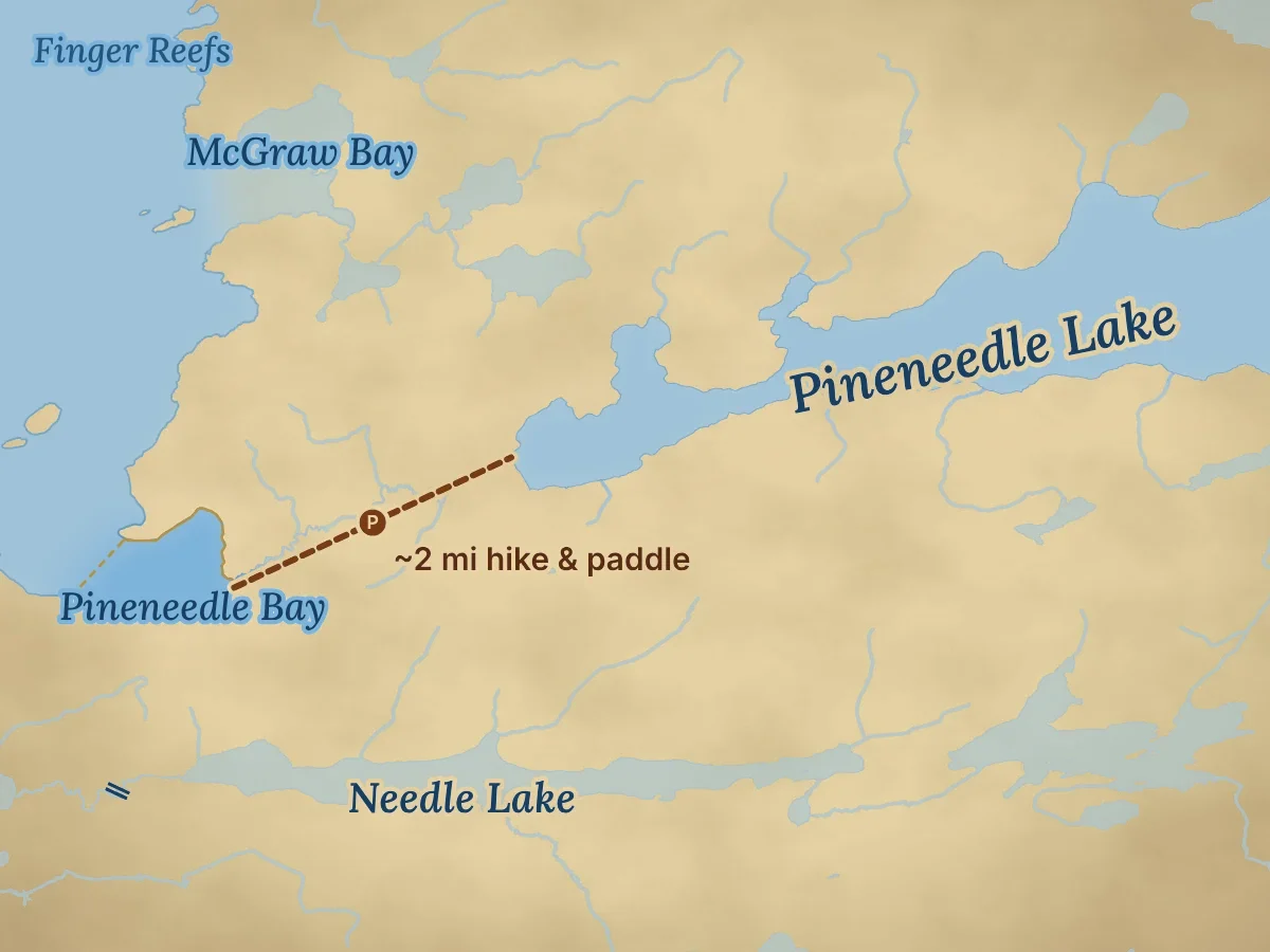
Map of Pineneedle Bay on Sydney Lake, Ontario, with the 2-mile hike-and-paddle route to Pineneedle Lake
Pineneedle Bay (gold outline) and the route to Pineneedle Lake, about 2 miles of hiking and paddling.Explore on the interactive map →

East side · fall trout shoals

Pineneedle Bay & the east shoals

120

Acres

40–60 ft

Deepest

~16 ft

Average depth

5 min

2.1 mi from camp

East-side shoals near Waiting Lady Island. In late September the lake trout move onto shallow rock and boulder patches, and you can cast for them. Early morning is best.

Pineneedle Lake

About 2,550 acres and over 210 feet deep, with lake trout, northern pike and a few walleye. The trail from Pineneedle Bay is a 1 to 1½ hour hike and paddle, and it is closed for now.

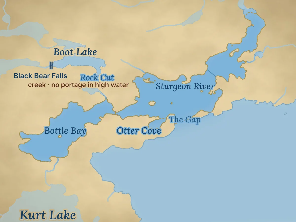
Map of Bottle Bay, Otter Cove and the mouth of the Sturgeon River at The Gap on Sydney Lake, Ontario, with the creek to Boot Lake
Bottle Bay, Otter Cove and the Sturgeon River (gold outline), with the creek up to Boot Lake.Explore on the interactive map →

West side · the river mouth

Bottle Bay, Boot Lake & The Gap

270

Acres in Bottle Bay

40–60 ft

Deepest

7 min

2.8 mi from camp

510

Acres of river

The Sturgeon River comes in from Kilburn on Sydney’s west side. Its wide mouth, The Gap, Bottle Bay and the creek up to Boot Lake are all within a few minutes of each other.

Bottle Bay & Boot Lake

Off the Sturgeon River. In most years you can run up the creek into Boot Lake with no portage. Dark, shallow water that warms first, and a waterfall at the far end.

The Gap

The wide mouth of the Sturgeon River. A ridge the size of three football fields rises to 5 feet, with 80 feet on the river side and 200 on the lake side. Fish 18–25 feet, and look for big pike here in September.

Up the river to Kilburn

Run up the Sturgeon River and through two narrows, with no portage. Tea-stained bays, three long arms, and walleye that stay shallow at the narrows right through July. About 14 minutes from camp.

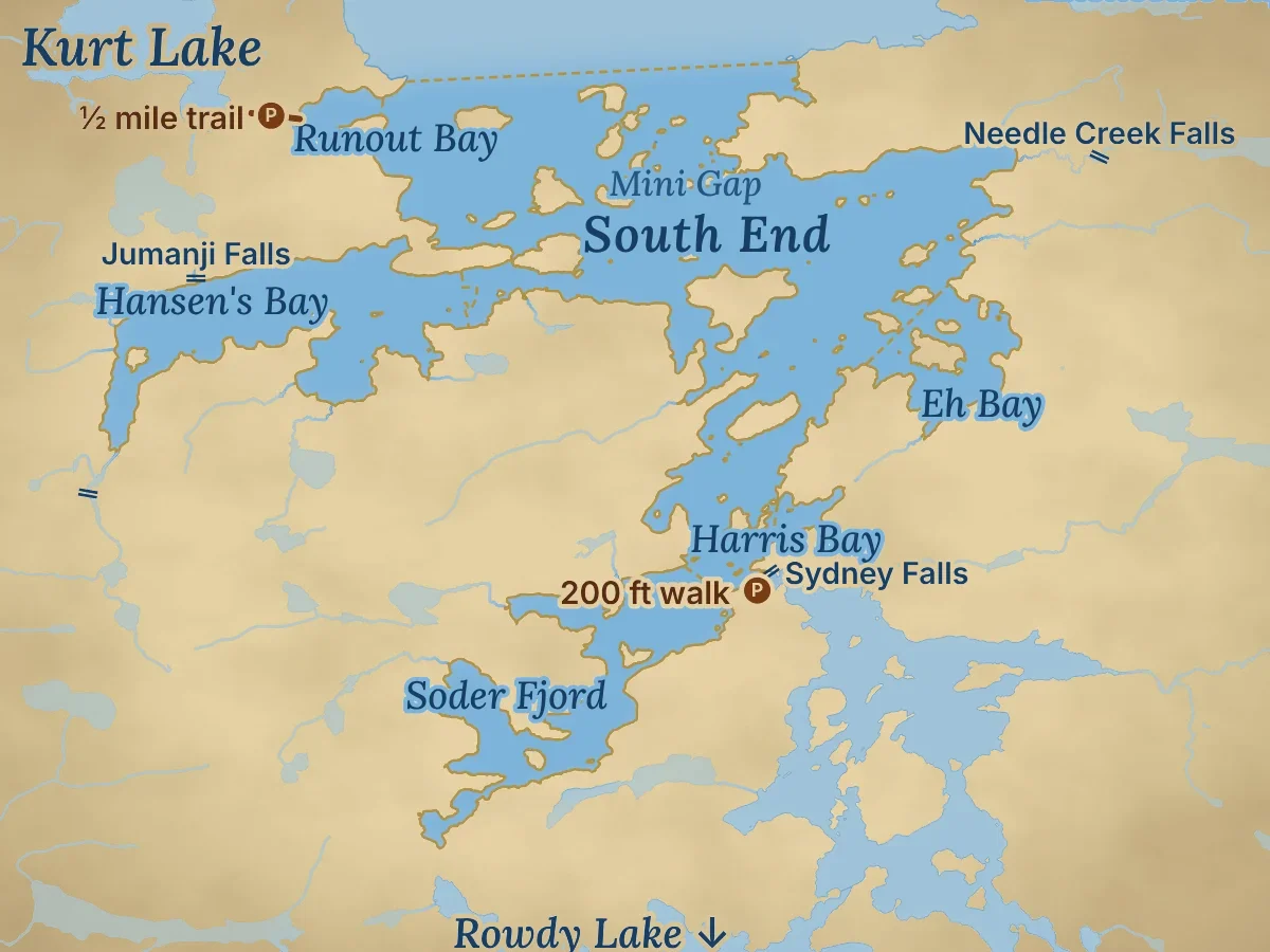
Map of the South End of Sydney Lake, Ontario, with Hansen's Bay, Soder Fjord, Sydney Falls and the trail to Kurt Lake
The South End and its bays (gold outline), with Sydney Falls and the trail to Kurt Lake.Explore on the interactive map →

Southwest of camp · islands and spawning bays

The South End & Sydney Falls

3,600

Acres, with its bays

100–150 ft

Deepest

58

Islands

~56 mi

Shoreline

5 min

1.7 mi from camp

The South End is a maze of islands and bays, with 58 islands and about 56 miles of shoreline. It ends at Sydney Falls, the lake’s only outlet.

Hansen’s Bay

One of the main spawning bays. Right after ice-out, walleye from all over the lake gather here in 3 to 10 feet of water.

The Mini Gap

A narrows through the islands to the south side, 8 to 25 feet deep. In late September you can catch walleye, pike and lake trout without moving the boat.

Sydney Falls & Rowdy Lake

The lake’s only outlet, a 7-foot drop at the south end. Walk the 200-foot portage and fish from shore below the falls. On a clear, calm afternoon you can watch walleye hit your bait.

Kurt Lake

About half a mile of trail from Runout Bay to a deep little lake with lake trout and pike. We keep a small boat at the end of the trail.

Panorama of Sydney Lake, Ontario

Sydney Lake from the water

Fishing Sydney Lake

Walleye, northern pike and lake trout on Sydney Lake

Sydney is a cold-water lake with a warm-water edge. About 40 percent of it is shallow enough for weeds and sunlight, so it holds both cold- and warm-water fish, and numbers and sizes run well above average for Northern Ontario.

The main event

Walleye

Bays in spring · reefs in summer

Walleye use both kinds of water. In late May and June they pack the dark, shallow bays: Mineral, Hansen’s, Tranquility and Bottle. By July and August they slide out to reefs, sunken islands and sharp breaks like the Finger Reefs, Blood Brothers Islands and The Gap. They’re heaviest in late August and September, after a summer of feeding.

More:Walleye fishing guide

Trophy pike

Northern pike

Creek mouths, weedy bays, rocky points

Pike hunt the edges: creek mouths, weedy bays, rocky points and the drop to deep water. They’re heaviest in late August and September. Our guests won the Ontario’s Trophy Waters prize for the season’s biggest pike two years running, with 46-inch pike in 2023 and 2024.

More:Northern pike fishing

Deep, cold water

Lake trout

25–45 ft in spring · 50–70 ft plateaus in summer

With a 65-foot average depth and a large area of 200-foot water, Sydney holds a lot of lake trout. In May you can troll for them right in front of camp. In summer, fish the edges of deep plateaus. In late September they move onto the rocky east-side shoals to spawn.

More:Lake trout fishing

Also in the lake

Forage and other fish

Cisco, whitefish and more

A lake survey also found sauger, lake whitefish, cisco (lake herring or tullibee), burbot, white and red suckers, spottail and blacknose shiners, bluntnose and fathead minnows, ninespine stickleback, trout-perch and Iowa darters. The cisco are what make the walleye and trout so heavy.

More:Why these lakes

Rivers, falls and portage lakes

The Sturgeon River and the lakes around Sydney

Sydney Lake sits near the headwaters of the Sturgeon River system, which flows south through Rowdy Lake and on to the English River.

Flowing in

Sturgeon River

Kilburn to Sydney · no portage

The river links Kilburn Lake to Sydney and enters at The Gap. Two narrows with a light current are the only tricky part: go slow, or give a few pushes with the paddle. The Hudson’s Bay Company kept a fur trading post on the river in the 1800s and early 1900s. A clearing still marks the spot.

More:Kilburn Lake

Flowing out

Sydney Falls & Rowdy Lake

7-foot drop · short portage

Sydney has a single outlet, at the south end. The falls drop 7 feet into Rowdy Lake, and from there the Sturgeon River runs south through several more lakes to the English River. The pool below the falls is a good shore-fishing spot for walleye.

Tip: clear, calm afternoons are best

Portage lake

Kurt Lake

½-mile portage · 208 ft deep

A deep little lake with plenty of lake trout and pike. The first 400 feet of trail climb through soggy ground, then it is easy going to the shore. We keep a small boat at the end of the trail; bring a small motor from camp. Try the first point on the west side and the lake side of the two reefs.

More:Portage lakes

Portage lakes

Middle Kilburn & more

330-ft portage from Kilburn’s West Arm

An easy 330-foot portage off the West Arm of Kilburn leads to Middle Kilburn, with lake trout, northern pike and walleye and a boat waiting. We also keep boats on Sidious, Jeb and Pineneedle Lakes for anglers who like a hike; the Jeb and Pineneedle trails are closed for now.

More:Portage lakes

Creek waterfall flowing into Hansen's Bay, Sydney Lake
Creek into Hansen’s Bay
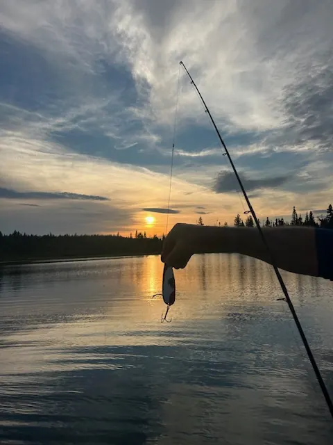
A fishing rod against the sunset on Sydney Lake, Ontario
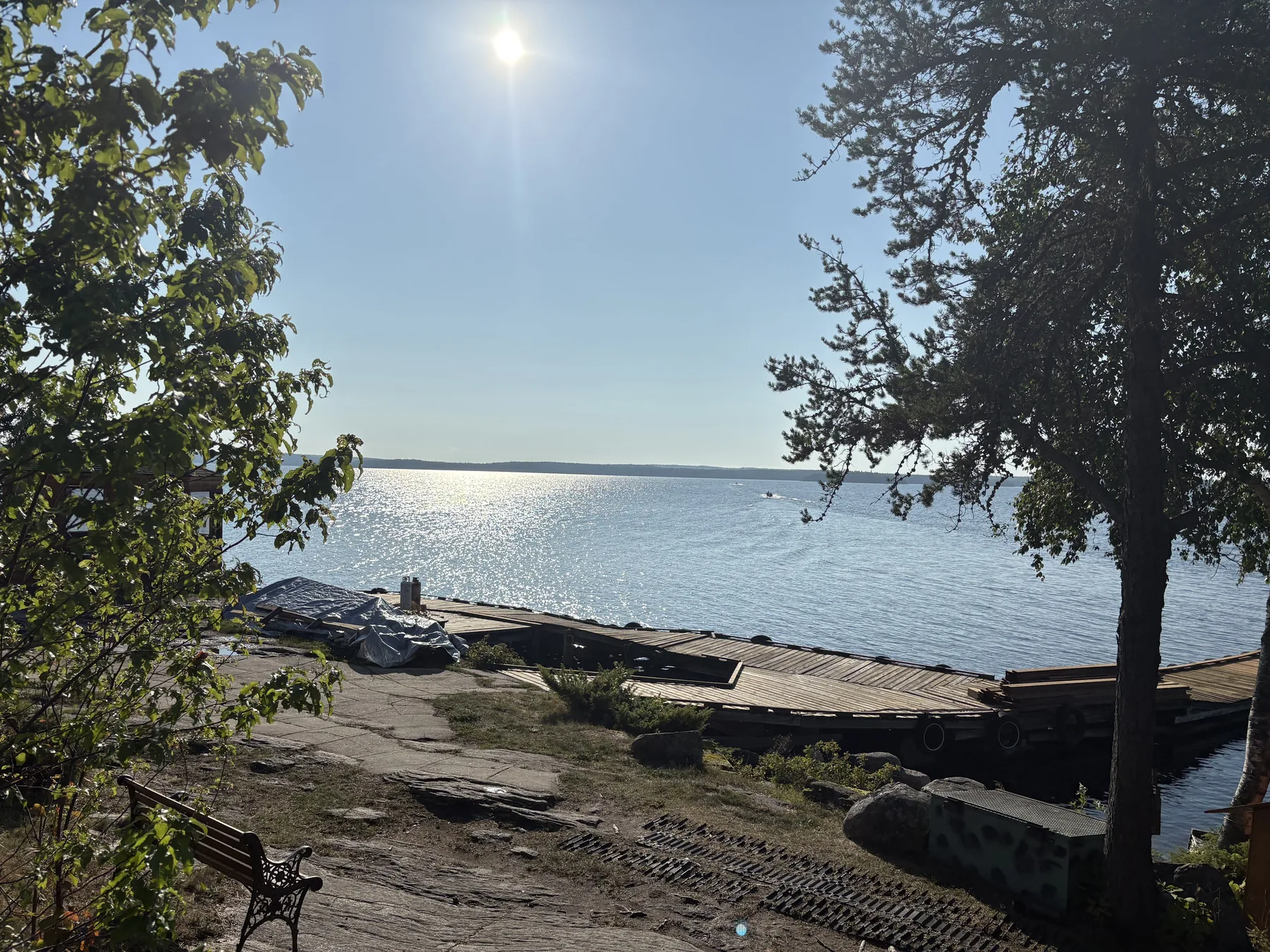
Rocky shoreline and pines in the sun on Sydney Lake
The shore on a sunny day

History and wilderness

Inside Woodland Caribou Park, and our home since 1933

Sydney and Kilburn lie at the south end of Woodland Caribou Provincial Park, about 1.1 million acres of protected boreal forest along the Manitoba border. They are also inside Pimachiowin Aki, a UNESCO World Heritage Site since 2018. Woodland caribou, moose, black bears, wolves, bald eagles, pelicans and loons live here, and guests see them often.

People have fished these waters for a very long time. In the late 1800s and early 1900s, First Nations families camped above Rowdy Falls, and there are pictographs on Pineneedle Lake, about 4 miles east of camp. The Hudson’s Bay Company kept a fur trading post on the Sturgeon River. My grandparents bought an old fishing camp here in 1933, and my grandfather built his first cabin and his own boats in 1947. We are still the only lodge on Sydney and Kilburn.

Sydney Lake is part of Ontario’s Trophy Waters, and we have practised catch-and-release of trophy fish since 1987. There is no stocking. Limits change, so check the current Ontario regulations before you come.

Woodland Caribou Park →
Sunset over the granite shore of Sydney Lake
Woodland caribou swimming in Sydney Lake
Woodland caribou
Moose standing in the water at Sydney Lake
Moose
Black bear on the shore of Sydney Lake, Ontario
Black bear

Questions

Sydney Lake, Ontario FAQ

Where is Sydney Lake, Ontario?

In the Kenora District of Northwestern Ontario, about 60 miles north of Kenora, at the south end of Woodland Caribou Provincial Park. It is a 30-minute float plane flight from #1 Second Street Dock in downtown Kenora.

How big and how deep is Sydney Lake?

About 14,240 acres counting the Sturgeon River, 14½ miles long and 3½ miles wide. The deepest spot is about 240 feet and the average depth is about 65 feet. With Kilburn Lake there are 17,570 acres to fish.

Can you drive to Sydney Lake?

No. There are no roads, no boat launches and no cottages. You fly in by float plane, or paddle and portage in by canoe. Ours is the only lodge on Sydney and Kilburn.

What fish are in Sydney Lake?

Walleye, northern pike and lake trout are the main game fish. Sauger, lake whitefish, cisco, burbot and several kinds of minnows live there too. There is no stocking; every fish is wild.

Plan your trip

Come fish Sydney Lake

Fly in from Kenora, settle into a lakeside cabin, and be fishing within the hour. The season runs from the third Saturday in May (May 15 in 2027) to September 30. Pick your dates and I’ll help you plan the rest.

Check dates →

More fishing on Sydney Lake: Walleye · Northern pike· Lake trout · Kilburn Lake

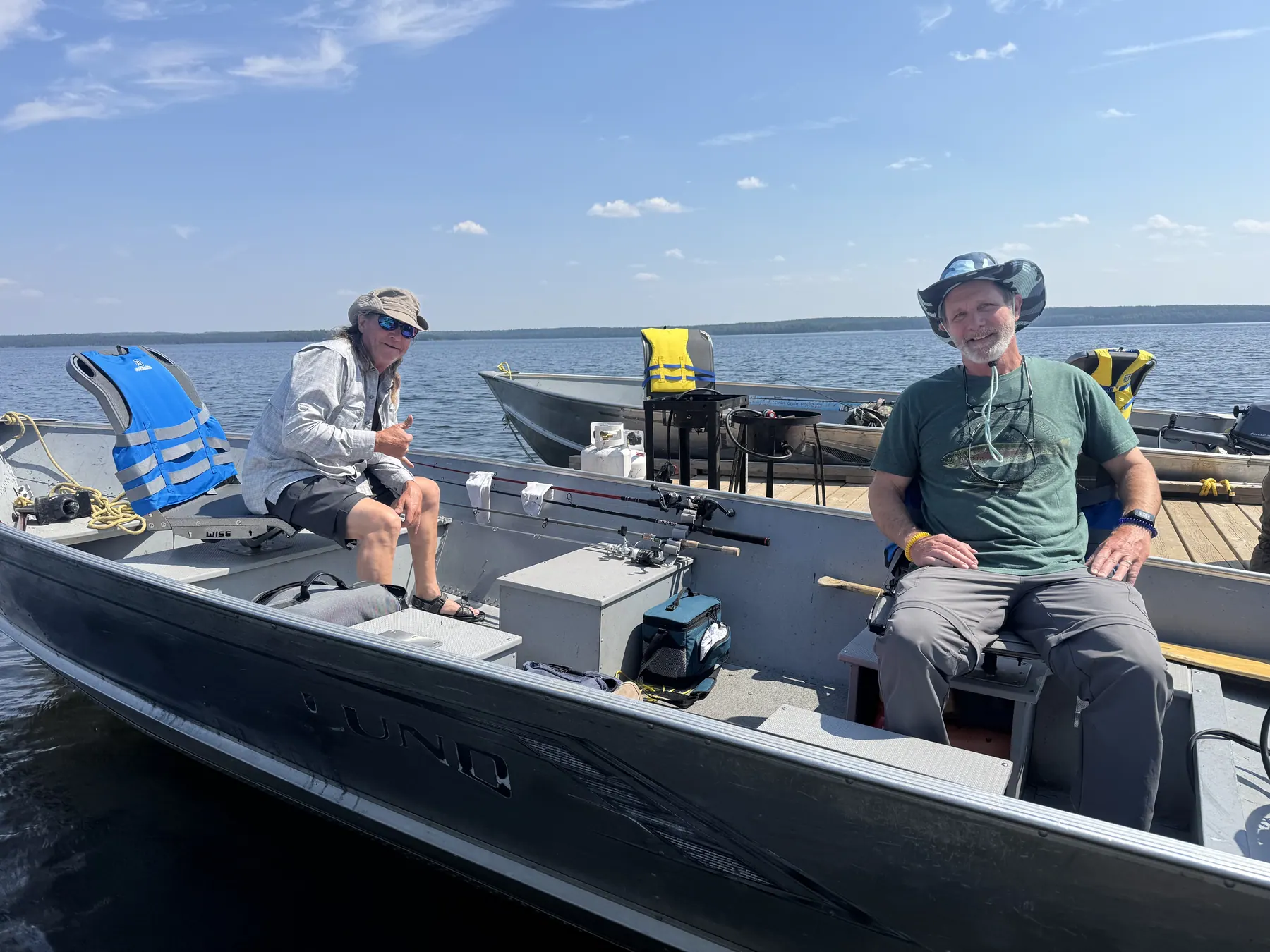
Two anglers fishing from a Lund boat on Sydney Lake