Pimachiowin Aki · UNESCO World Heritage Site
Sydney and Kilburn Lakes lie inside Pimachiowin Aki, “the land that gives life,” the first place in Canada listed by UNESCO for both its culture and its nature. Red ochre rock paintings, unbroken boreal forest and thousands of lakes, with ours the only lodge on either lake.

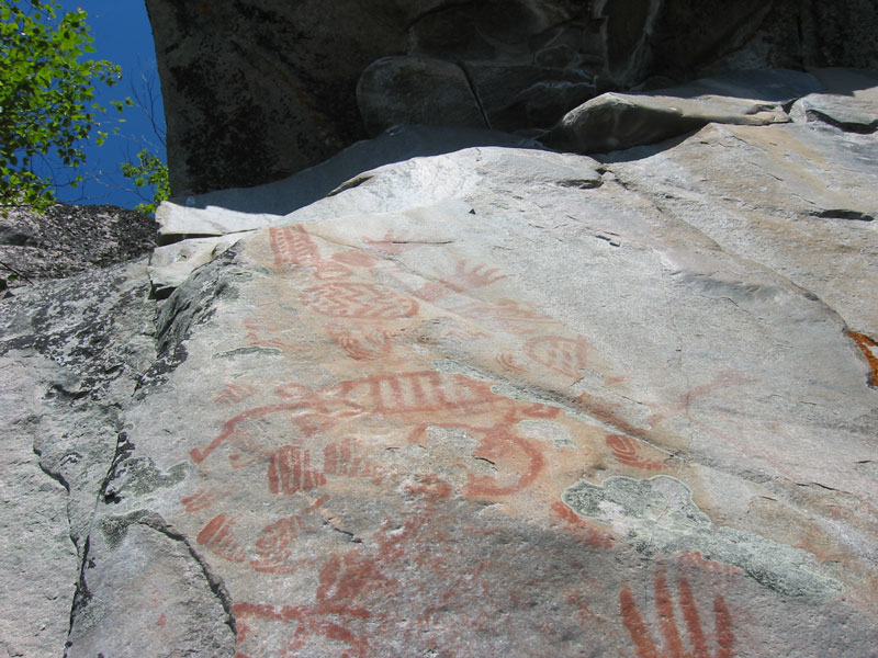
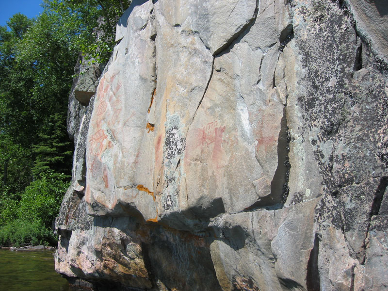
Red ochre rock paintings near Sydney Lake
2018
Canada’s first mixed World Heritage Site
Inscribed on July 1, 2018, for its living Anishinaabe culture and its natural boreal forest together.
7.2M
acres of boreal shield
29,040 km² of forest, rivers and lakes across Manitoba and Ontario, larger than the state of Vermont.
7,000+
years of Anishinaabe life here
The ancestral home of the Anishinaabeg, who still fish, hunt, trap and gather on this land today.
4
Anishinaabe First Nations
Bloodvein River, Little Grand Rapids, Pauingassi and Poplar River care for the site with Manitoba and Ontario.
Inside the World Heritage Site
Pimachiowin Aki stretches across the Manitoba–Ontario border, from the east shore of Lake Winnipeg to the Woodland Caribou country north of Kenora. It joins the traditional lands of four Anishinaabe First Nations with Manitoba’s Atikaki Provincial Park, Ontario’s Woodland Caribou Provincial Park and the Eagle-Snowshoe Conservation Reserve. Sydney and Kilburn Lakes sit at its southern edge, inside Woodland Caribou Park.
UNESCO added it to the World Heritage List in 2018 as Canada’s first “mixed” site, protected for its culture and its nature together. The Anishinaabeg call their way of caring for the land Ji-ganawendamang Gidakiiminaan, “keeping the land”: honouring the Creator’s gifts, respecting all life and keeping good relations with others. That tradition is a big part of why this country is still as wild as it is.
For you, it means fishing water that has been looked after for thousands of years. There are no roads, no cottages and no logging in the park, and there are long stretches of shoreline where the only sign of people is a red ochre painting on the rock.
My family has fished Sydney Lake since 1933, long before there was a park or a World Heritage listing. We try to run the lodge in the same spirit as keeping the land: take care of the lake, let the big fish go, and leave it as wild as we found it.
Woodland Caribou Park →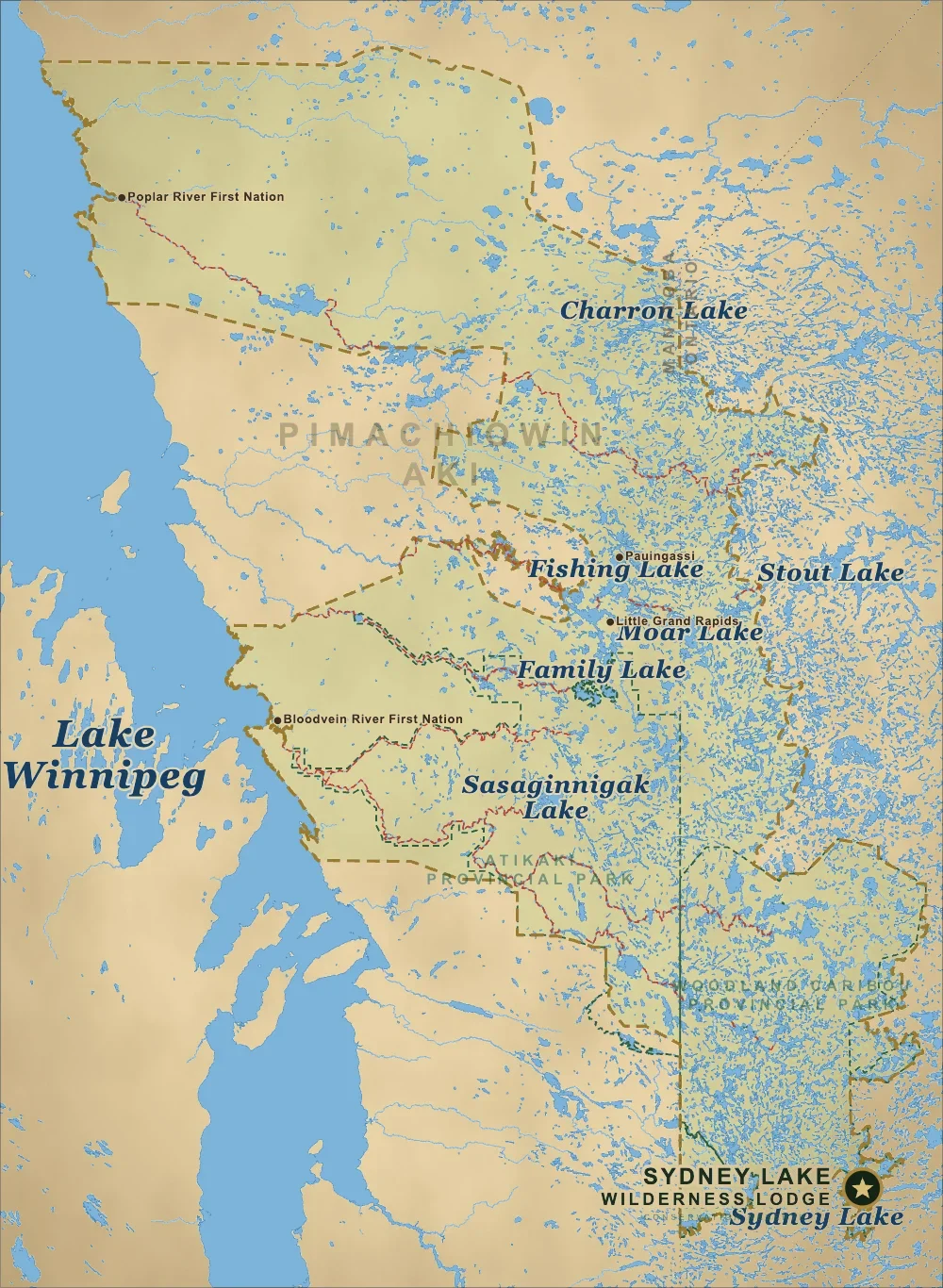
Where it is
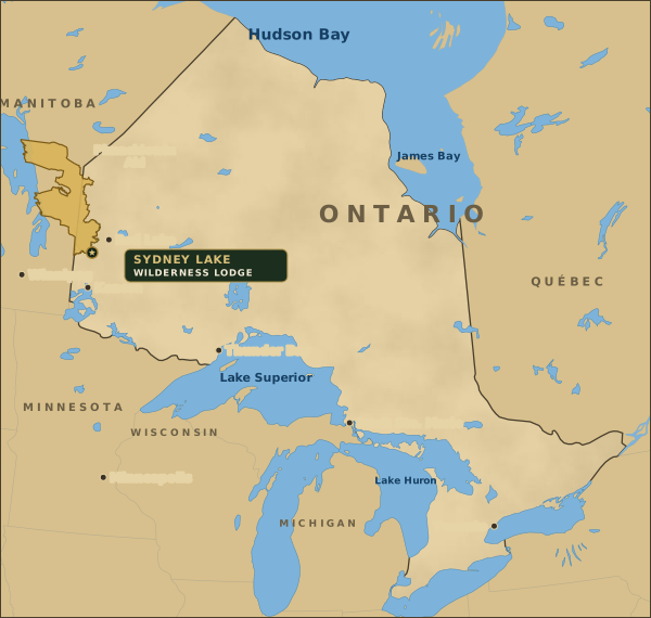
The site runs nearly 200 miles north to south, from the Woodland Caribou country west to Lake Winnipeg. Sydney Lake is the star at its south end. Click the map to open the full-screen version: switch to satellite view, turn the canoe routes on or off, and point at any lake to see its name.
The lodge
The star at the south end, inside Woodland Caribou Park. Kenora is 60 miles south, about 30 minutes by float plane.
World Heritage boundary
The gold dashed line around the four First Nations’ lands, Atikaki and Woodland Caribou parks and the Eagle-Snowshoe Conservation Reserve.
Canoe routes
The red dashes: Woodland Caribou’s marked routes, plus the big Manitoba rivers like the Bloodvein, Pigeon and Berens that people have travelled by canoe for thousands of years.
Satellite view
Flip the switch to see the forest, rock and old burns from space.
Why it was listed
UNESCO lists it under three criteria, two for culture and one for nature. It was the first place in Canada recognized for both at once.
Criterion (iii)
Ji-ganawendamang Gidakiiminaan, “keeping the land”
UNESCO recognized the Anishinaabe way of keeping the land as an outstanding, still-living tradition. Families use the same trap lines, harvest sites, camps and travel routes their ancestors did.
If you come across a camp or trap line, leave it as you found it.
Criterion (vi)
Pictographs, Thunderbird nests, named places
The land holds pictographs, Thunderbird nests and places where the memegwesiwag, the little rock people, are said to live, along with ceremonial sites and named places that carry history and directions.
Not every site is shared publicly, and that’s on purpose.
Criterion (ix)
Wolves, caribou, moose, lake sturgeon
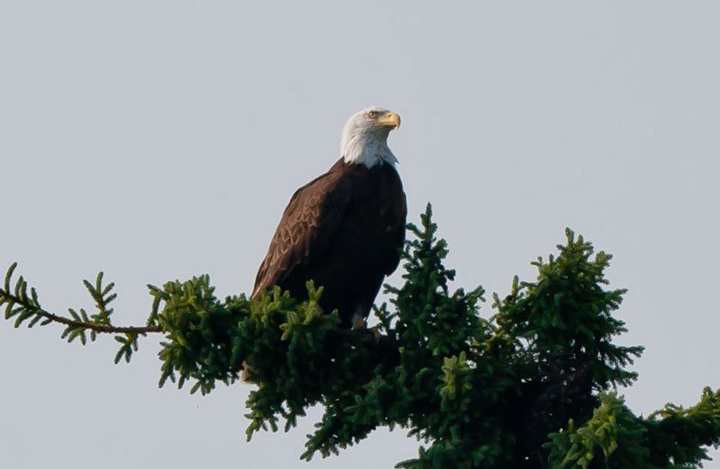
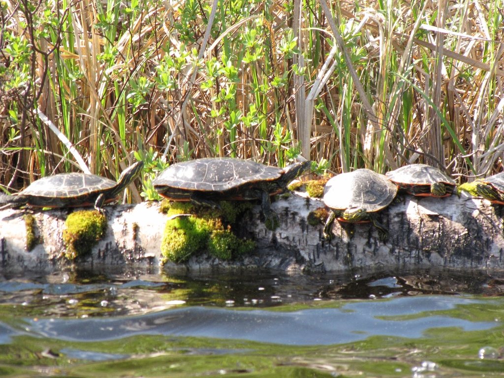
It’s one of the last big, unbroken pieces of southern boreal forest. Fire still renews the forest, wolves still hunt caribou and moose, and lake sturgeon, loons and Canada warblers live in its rivers and woods.
The old burns you see from the plane are part of that natural cycle.
Waterways
Bloodvein, Berens, Pigeon and Poplar
For thousands of years people travelled by canoe, linking camps, harvest sites and communities along the rivers and chains of lakes. The Bloodvein is a Canadian Heritage River, and its waterway holds the largest collection of pictographs in Canada.
Most canoe trips here last a week or more.





Quick answers
The short version: our lakes are inside the World Heritage Site, there are rock paintings a portage away on Pineneedle Lake, and you can fish it all from a cabin and a boat.
Location
Yes. Sydney and Kilburn Lakes are inside Woodland Caribou Provincial Park, which is part of Pimachiowin Aki. The lodge sits near the site’s southern boundary, 60 miles north of Kenora, Ontario.
Rock paintings
Yes. There are red ochre pictographs on Pineneedle Lake, close to camp and reached by a portage from Sydney Lake. We’ll show you the way. Look and take photos from the canoe or shore, don’t touch or wet the paint, and if you want to follow local custom, leave a small offering as you pass.
The fishing
Yes. Fishing has always been part of life here. You need an Ontario fishing licence, and our lakes are also in Ontario’s Trophy Waters, with lower catch limits and big fish released alive. Walleye, trophy northern pike and lake trout are all here.
Visiting
Mostly by float plane or canoe, since no roads run through the parks. Paddlers fly in from Red Lake or start from road ends in Manitoba and Ontario, usually for a week or more. Our guests drive to Kenora and fly 30 minutes to a cabin and a boat.
Visiting respectfully
The paintings were made with red ochre mixed with fish oil or bear fat, and they range from a few centuries to thousands of years old. Pimachiowin Aki’s Guardians, community members who look after the sites, ask visitors not to touch or wet the paint and to leave no trace behind. Some sites are sacred and are never shared, so the map leaves all of them off. Photos from the boat are fine, and many people leave a small offering when they pass.
Open the Pimachiowin Aki map →Explore more: Sydney Lake · Kilburn Lake · Portage lakes · Ontario’s Trophy Waters · Woodland Caribou Park